A substation inspection case study is most useful when it shows more than impressive imagery. Operations and maintenance teams need to know what was found, how the data was collected, what limitations applied, and how the results supported a defensible next step.
The following representative scenario reflects a common challenge at an operating electrical substation: obtaining clear, current condition data on critical equipment without adding unnecessary exposure, disrupting operations, or sending personnel into difficult viewing positions for every question.
The operating problem: limited visibility, growing uncertainty
A utility operations team needed a better view of a medium-to-large substation following a period of elevated load and severe weather. The team had routine maintenance practices in place, but several assets required closer attention based on age, prior work history, and observations made from the ground.
The concern was not that a drone flight would replace the utility’s inspection program, engineering review, or established safety procedures. The need was more practical: gather organized visual and thermal documentation that could help the right people decide where a closer ground-based investigation was warranted.
Traditional inspection methods can be effective, but they carry real constraints. Ground observers may not have clear sightlines to elevated conductors, bus components, insulators, connections, arresters, radiators, or equipment surfaces located behind fencing and structural elements. Climbing, bucket access, and outage-related work can require more planning, more labor, and more operational coordination.
For this assignment, the objective was to collect condition data efficiently while keeping the inspection scope disciplined. The final deliverable needed to give maintenance personnel a usable record of the site, not a folder of unorganized aerial photos.
Defining the inspection scope before deployment
A productive aerial inspection begins well before launch. For a substation, the flight plan, data requirements, access restrictions, weather conditions, and coordination process all matter. The work must be planned around the facility’s rules and the operator’s safety requirements, not around a desire to capture every possible angle.
The project team identified priority equipment and areas of interest, including transformer exteriors, bushings, radiator banks, disconnects, circuit breakers, visible connections, insulators, overhead bus structures, control-house roof conditions, perimeter access points, and drainage conditions around equipment pads.
The requested deliverables included high-resolution visual imagery, radiometric thermal imagery where conditions allowed meaningful collection, annotated findings, and an organized image set tied to asset locations. A broad overhead site overview was also included to help personnel orient individual findings within the larger facility.
This early alignment prevented a common failure point in inspection work: collecting substantial data that cannot be quickly connected to an asset, a location, or a maintenance decision.
Thermal data requires the right conditions
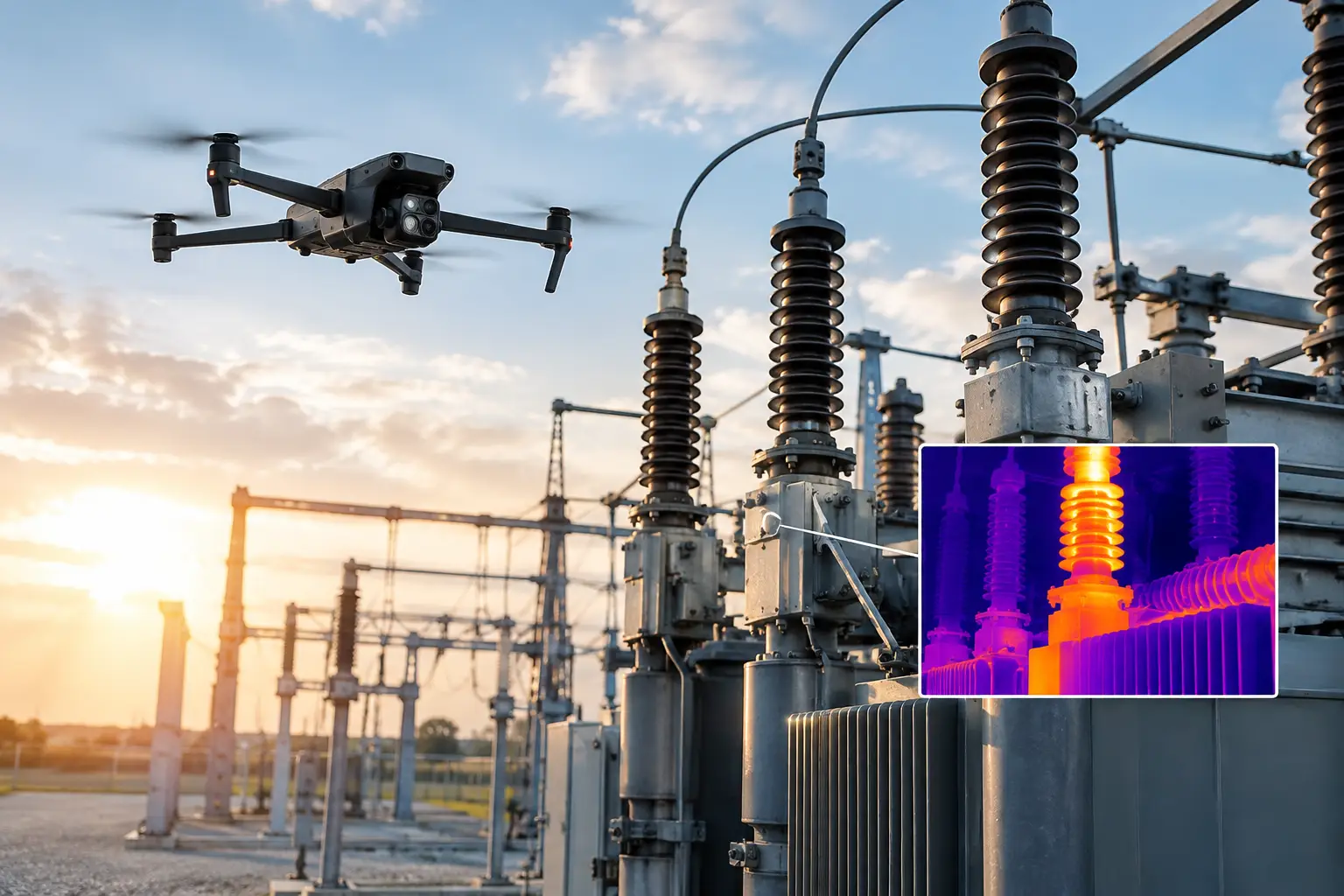
Thermal imaging can reveal temperature differences that deserve attention, but it is not a stand-alone diagnosis. Load level, sun exposure, wind, surface material, viewing angle, emissivity, reflection, and time of day can all affect what the sensor records.
In this case, the inspection window was selected to support useful comparisons. The aerial team coordinated timing with facility personnel, confirmed applicable operational constraints, and documented relevant collection conditions. Images were reviewed in context rather than treated as proof of failure.
That distinction matters. A thermal anomaly may point to a loose connection, load imbalance, deteriorating component, reflection, or another condition that requires follow-up. The aerial inspection supports prioritization and documentation. Qualified utility and engineering personnel determine the cause and appropriate corrective action.
Field execution: collecting repeatable, asset-focused data
The field crew established the operating area, completed preflight checks, verified site coordination, and followed the agreed collection plan. Around energized infrastructure, disciplined operations are essential. The purpose is not to fly as close as possible. It is to capture the required data while maintaining appropriate separation, control, and situational awareness.
Visual collection focused first on wide views that established context, then on detailed oblique imagery of priority components. This sequence gave the maintenance team both the close-up condition view and the surrounding equipment relationship. For example, an image of a suspected connection is more useful when reviewers can also identify its position within a bay or transformer assembly.
Thermal passes were then completed on equipment where a stable, repeatable vantage point could be maintained. Rather than relying on one image from one angle, the crew captured supporting views where practical. This helped distinguish a potential equipment-related temperature difference from glare, reflected energy, or a viewing-angle issue.
The team also recorded visible non-thermal conditions. These included damaged or contaminated-looking insulators, corrosion, loose or degraded hardware, vegetation concerns near the perimeter, standing water around pads, damaged labels, and roof or enclosure conditions. Not every observation was urgent, but documenting it created a current baseline for the facility.
What the inspection found
The review identified three categories of findings: items requiring prompt technical follow-up, lower-priority conditions to monitor, and baseline documentation with no obvious concern visible from the collected data.
One connection area showed a noticeable temperature difference compared with similar nearby components under comparable operating conditions. Because the pattern appeared consistent across supporting images, it was flagged for utility review and follow-up inspection. The aerial data did not identify the root cause, but it helped the maintenance team focus attention on a specific location rather than conduct a broad, less targeted search.
A second set of observations involved exterior condition issues. Several areas showed surface corrosion and weathering that were not immediate evidence of a functional defect, yet they were useful for maintenance planning. High-resolution imagery allowed reviewers to compare the condition against prior records and determine whether the observed deterioration appeared stable or progressing.
The inspection also documented drainage and access conditions around portions of the site. This was not the central reason for the mission, but it showed the value of collecting a complete operational picture when the aircraft is already deployed. Site conditions that affect maintenance access, water management, or future construction planning can be easier to assess from an elevated perspective.
The value was in the decision process, not the flight
The strongest outcome from this substation inspection case study was not simply faster image collection. It was the ability to move from general concern to a prioritized work list with clear visual support.
Instead of asking personnel to review hundreds of disconnected files, the final package organized observations by equipment area and included annotated images for the items needing attention. Reviewers could see the thermal observation, compare it with visual imagery, locate the asset in the site overview, and determine the next appropriate action.
That workflow reduced time spent locating and interpreting information. It also provided a documented condition record that could support maintenance discussions, contractor scoping, internal reporting, and future comparison inspections.
There are trade-offs. Aerial collection may not capture concealed defects, internal component conditions, or every angle blocked by equipment geometry. Weather, active operations, airspace requirements, and site access can affect scheduling. In certain situations, a ground inspection, infrared survey from a different position, or hands-on examination remains necessary.
But those limitations do not reduce the value of aerial data. They define how to use it correctly: as an efficient layer of visual intelligence that helps teams send people, time, and resources where they are most needed.
What infrastructure teams should take from this example
Substation owners and operators benefit most when aerial inspections are tied to an established maintenance or engineering workflow. Before scheduling a mission, define the decisions the data needs to support. That may include identifying locations for closer review, documenting storm impacts, monitoring known conditions, preparing maintenance scopes, or creating a baseline before major work.
It also helps to specify the final format before fieldwork begins. A maintenance manager may need annotated imagery by asset. An engineering group may need orthomosaic mapping or 3D context. An insurance or risk team may need dated documentation showing condition after a weather event. The collection plan should reflect those different needs.
Air Reel Technologies supports this type of disciplined, asset-focused aerial documentation for utilities and critical infrastructure teams. FAA Part 107-certified operations, professional insurance coverage, and field-tested planning help ensure that collection is approached as operational work, not casual aerial photography.
For the teams responsible for high-value electrical assets, the practical question is not whether a drone can see more than a ground observer. It often can. The better question is whether the inspection data will arrive organized, contextualized, and ready to support the next maintenance decision.