Drone Inspections, Thermal Imaging and Search and Rescue
Drone technology is in the business of saving lives by going where people can’t easily go without substantial risk. Turn to Air Reel for reliable and efficient commercial inspections that are quick, cost-effective, accurate, and safety conscious.

- Buildings
- Bridges
- Railroads
- Roof tops
- Drainage systems
- Roads inspections
- Wind Generators
- Transmission lines
- Industrial
- Construction sites

Put sharp digital eyes on hard to reach spots up close without endangering personnel or using
the structure itself by having people on it.
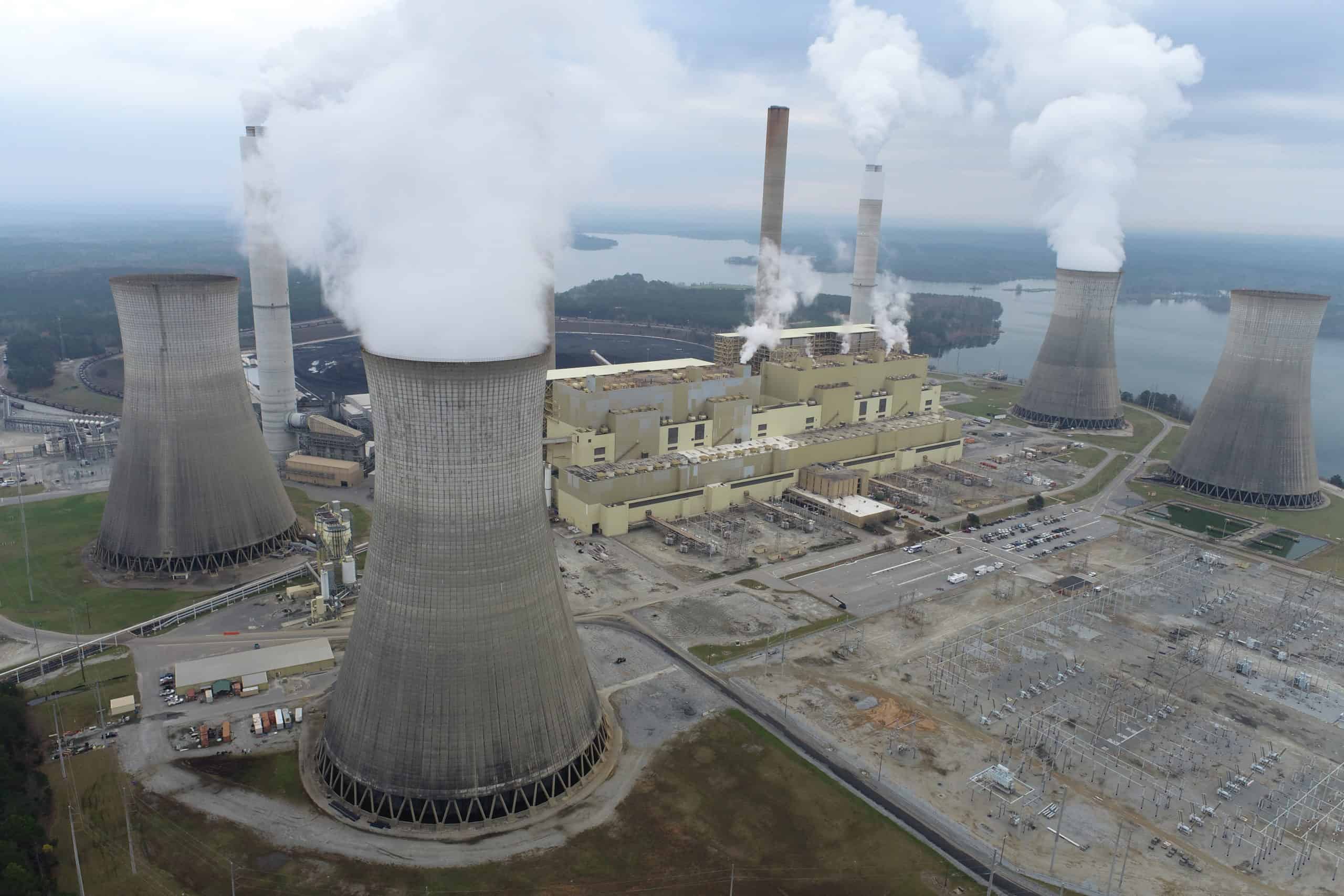
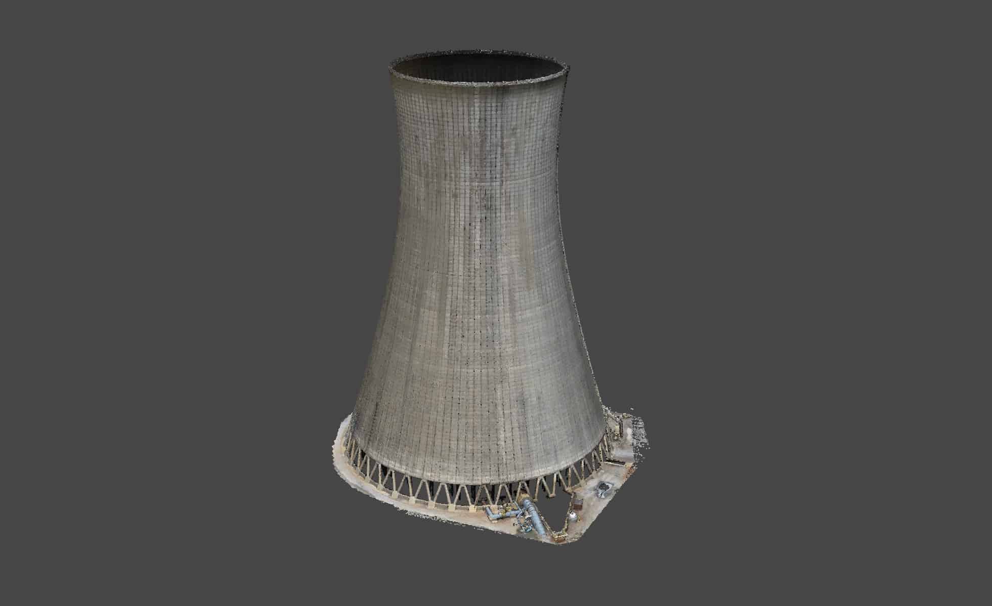
Use Air Reel to safely inspect and document with aerial photography and video those dangerous, elevated, or hard to reach industrial areas, assets, and properties. Using the best in high resolution visual cameras, our drones capture accurate and actionable data for engineering projects, maintenance inspections, project documentation, road and bridge inspections, construction surveys and computing stockpile volumes.
With commercial drones having become so advanced so quickly, they are now a standard platform to safely, accurately and reliably capture images from a variety of elevations. Air Reel can take a traditional survey and greatly enhance it by using evolving technology to create an accurate survey
Drone Inspections, Thermal Imaging and Search and Rescue
One area where UAVs may play an important part in the future is in the crash scene reconstruction. The National Criminal Justice Research, Test and Evaluation Center (NIJ RT&E Center) is performing an operational evaluation of UAS for Crash Scene Reconstruction. The objective of this evaluation is to evaluate the utility of a UAS to support crash scene reconstruction in an operational law-enforcement setting.
The study will determine whether a UAS could be used to improve crash scene reconstruction in terms of quality, safety, timeliness, or other metrics. Based upon previous investigations, the Center has identified a number of agencies that have operational UAS capabilities configured to support law enforcement. The Center is now seeking to partner with those or other interested agencies in order to complete the operational evaluation. The focus of the study is on the use of UAS for crash scene reconstruction; however, information on alternative uses of UAS in law enforcement is also requested.
Follow the link for more information about this study from the National Criminal Justice Research, Test and Evaluation Center.
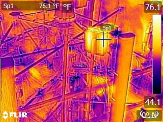
Thermal Drone Inspections and Search and Rescue
Thermal imaging inspection enables you to see visual issues, errors or losses which may somehow go undetected. You can find issues earlier and prevent problems in difficult areas. Thermal imaging provides inspection, Survey & mapping using professional radiometric thermal camera and drones.
Our services securely and rapidly identify hotspots and regions with abnormal temperatures utilizing our drone Thermal Imaging Service.
Together aerial and mapping procedures can distinguish thermal sources over large regions.
By using the professional UAV thermal imaging instruments we can provide thermal and advanced photographic records in either unedited or completely processed format with inspection reports.
Where you can use these drones?
- Industrial Plants
- Oil and Pipeline inspection
- Offshore Rigs
- Environmental & Bio-security
- Solar Panel Inspection
- Power Distribution Inspection area
- For building inspection
- Mine Site etc.
The bottom picture is myself lying down in the grass and the drone is at 150ft. This is high enough to clear almost all obstacles and low enough to identify a missing or injured person, a hiding suspect, or lost animal.


Trusted Partners
We work with you to get the product you need.


Get A Quote Today
Please fill out this form to let us know how we can help you better.