Do You Have A Construction Project We Can Help With?
Manage Your Projects With Confidence
From start to finish we will take care of all the aerial needs. You tell us what you need or want to see and we will put together a plan to make it happen. From weekly, bi-weekly or monthly shots and/or video from the entire construction site to just a progress picture, we can have it done and in your inbox on the same day. As an extra bonus, if you want to check a site in real time, we can do that too. We can stream to your desktop or mobile phone from the drone in near real time so you know whats going on with your project.
Drones provide value on the job site daily
There is no longer any question that drones save time and reduce costs compared with traditional ground and aerial techniques. Aerial surveys of projects that were considered too small for manned aircraft operations are now commonplace with drones.
Construction Management
The $8.5 trillion global construction industry is both massive and far flung—there is no place in the world that does not build things. The industry’s problems reflect an age-old tradition of architects and engineers throwing plans over the wall to be reworked by contractors and subcontractors. It’s not that the system doesn’t work—it’s that the rework eats up increasingly thin margins, wastes huge amounts of material, and creates massive delays. And since much of it is on paper, trying to integrate and keep track of complex projects is no easy task.
Progressive Aerials Provide Value
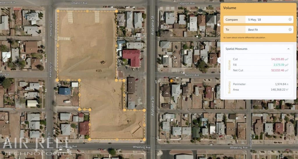
Weekly or Bi-Weekly progressive aerials give management a overall view of what progress has been made on a site. It is able to show so much more than just walking around a site and taking pictures. At the same time, it can be done without the PM ever leaving the office in case he/she is busy meeting another deadline.
Progress aerials can be done in any way your workflow requires. From an overlay showing the previous aerial, to consecutive pictures of each week, to HD video to show shareholders. Let us know what you need and we will get it done.


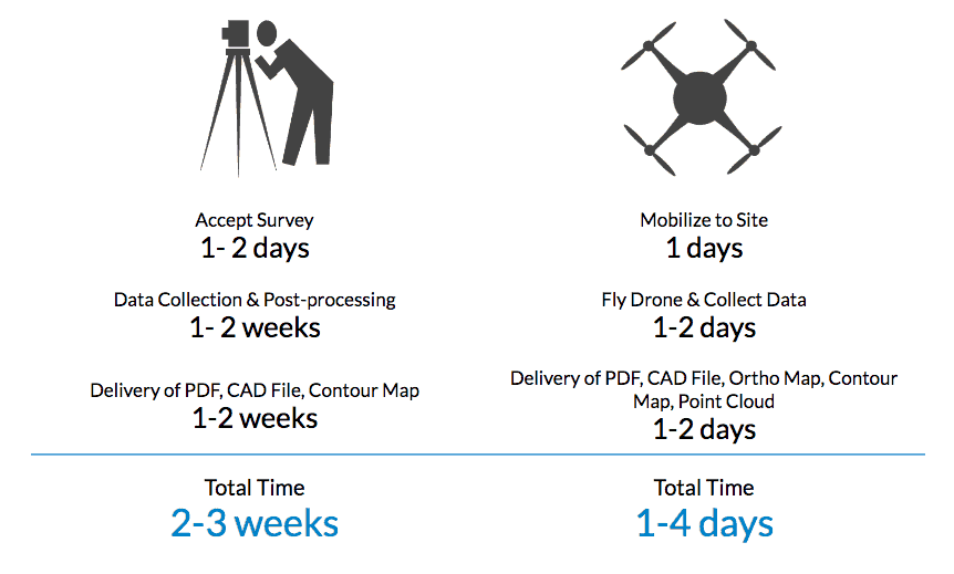
What We Can Deliver
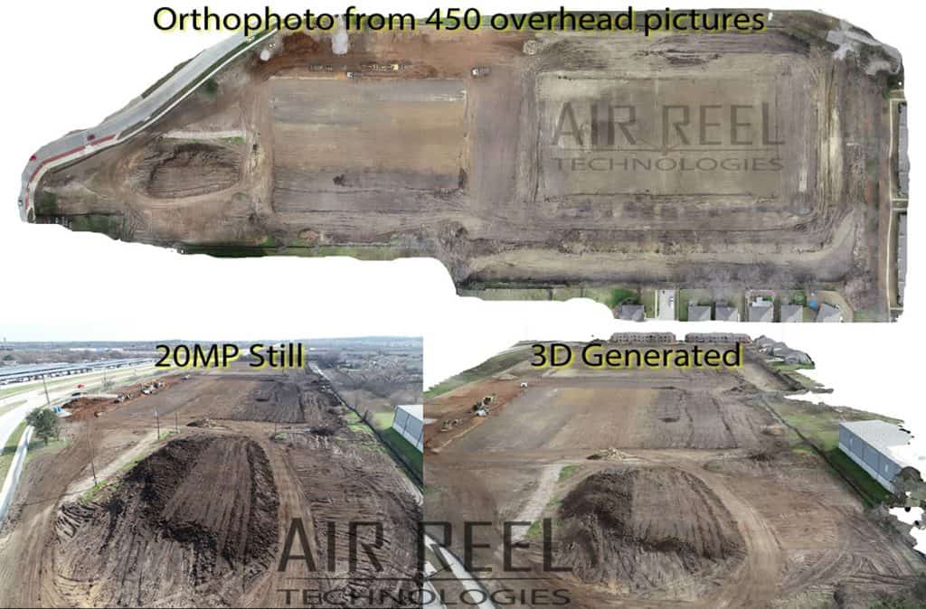
Here drones can make a huge difference. Instead of analyzing over line drawings and elevations in CAD, a more proactive approach is to analyze 3D data with complete aerial analytics. A key advantage of thinking about aerial analytics rather than drawing is that they are highly detailed and can be produced in quick time, making it possible to conduct studies and planning in a much shorter time span.
Traditionally, most of the GIS analysis has relied on satellite and land survey. However, the drawback of this “time taking approach” is that it is reactive—we have to wait longer for data collection and processing in order to plan the next move. In a high-traffic situation, only a few days are needed to collect enough data required for an analysis.
Air Reel Technologies is on the front line of innovation, offering our customers a one of a kind technology to summarize and abridge their projects in a progressed and polished way.
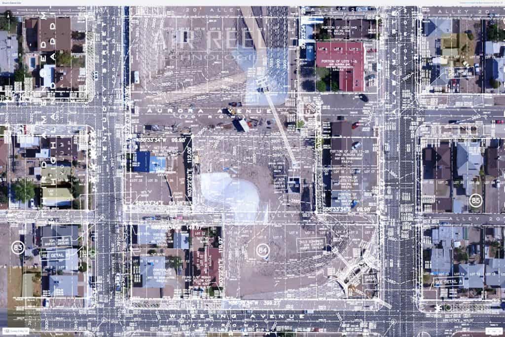
- Map/Plan Overlay.
- 3-D Models.
- BIM.
- Project Video.
- Aerial Documentation.
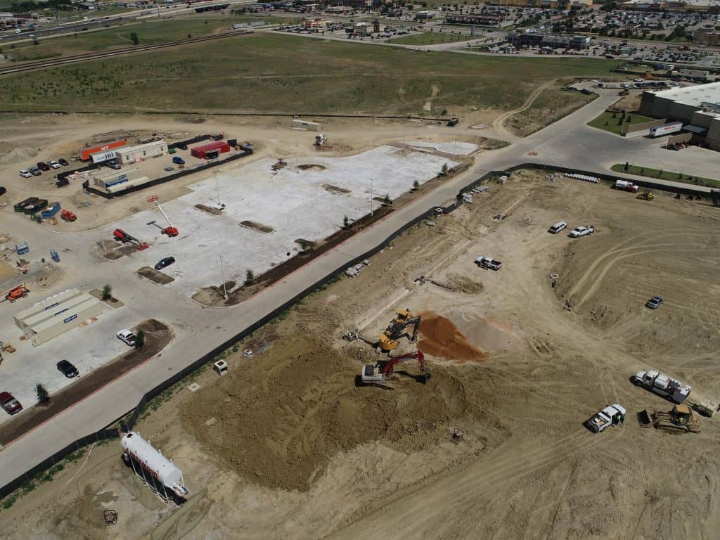
Air Reel Technologies Construction Site
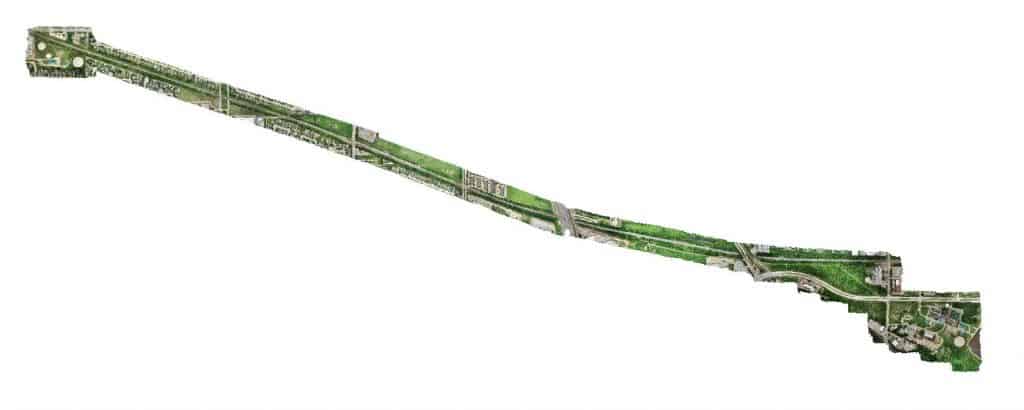
Air Reel Technologies Linear Orthophoto

Air Reel Technologies Site Panorama
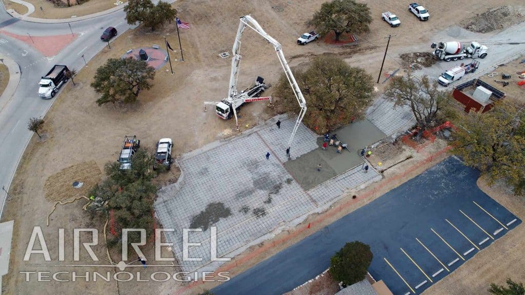
Air Reel Technologies Pad Pour
Get A Quote Today
Please fill out this form to let us know how we can help you better.


