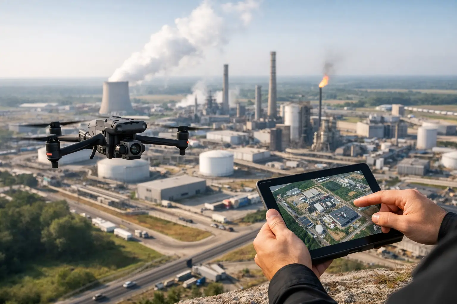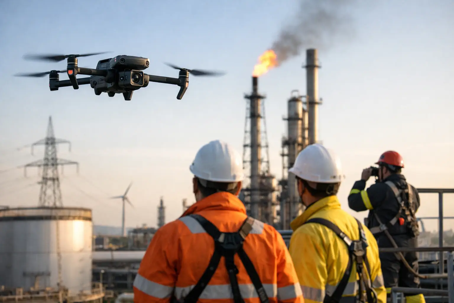
A shutdown window gets tighter, a tower climb needs to be scheduled, or a storm leaves damage spread across multiple sites. In those moments, industrial drone services are not a nice extra. They are a practical way to collect accurate visual data without sending more people into difficult, time-sensitive, or high-risk conditions than necessary.
For construction firms, utilities, plant operators, engineers, and insurance teams, the value is straightforward. Better aerial data can shorten inspection timelines, improve documentation, and support decisions with current imagery, thermal views, maps, and models. The real advantage is not the aircraft itself. It is the ability to get useful information from places that are expensive, hazardous, or disruptive to access through traditional methods.
What industrial drone services actually do
The term gets used loosely, which can create confusion. Industrial drone services are not about general aerial photography. They are built around field operations, asset documentation, inspection support, and data capture for real business decisions.
That might mean mapping a construction site to track grading progress and stockpile changes. It might mean capturing close visual imagery of a cell tower, flare stack, cooling tower, industrial rooftop, or transmission structure so maintenance teams can review conditions without an immediate climb. It could also mean thermal imaging to identify heat anomalies on electrical components or building systems, or post-storm documentation that helps insurance and operations teams understand the scope of loss quickly.
The deliverables matter as much as the flight. High-resolution images, orthomosaic maps, 3D models, thermal files, annotated findings, and organized inspection imagery are what make the work useful. A serious provider is not just flying a drone. They are building a repeatable workflow that produces usable documentation.
Where industrial drone services create the most value
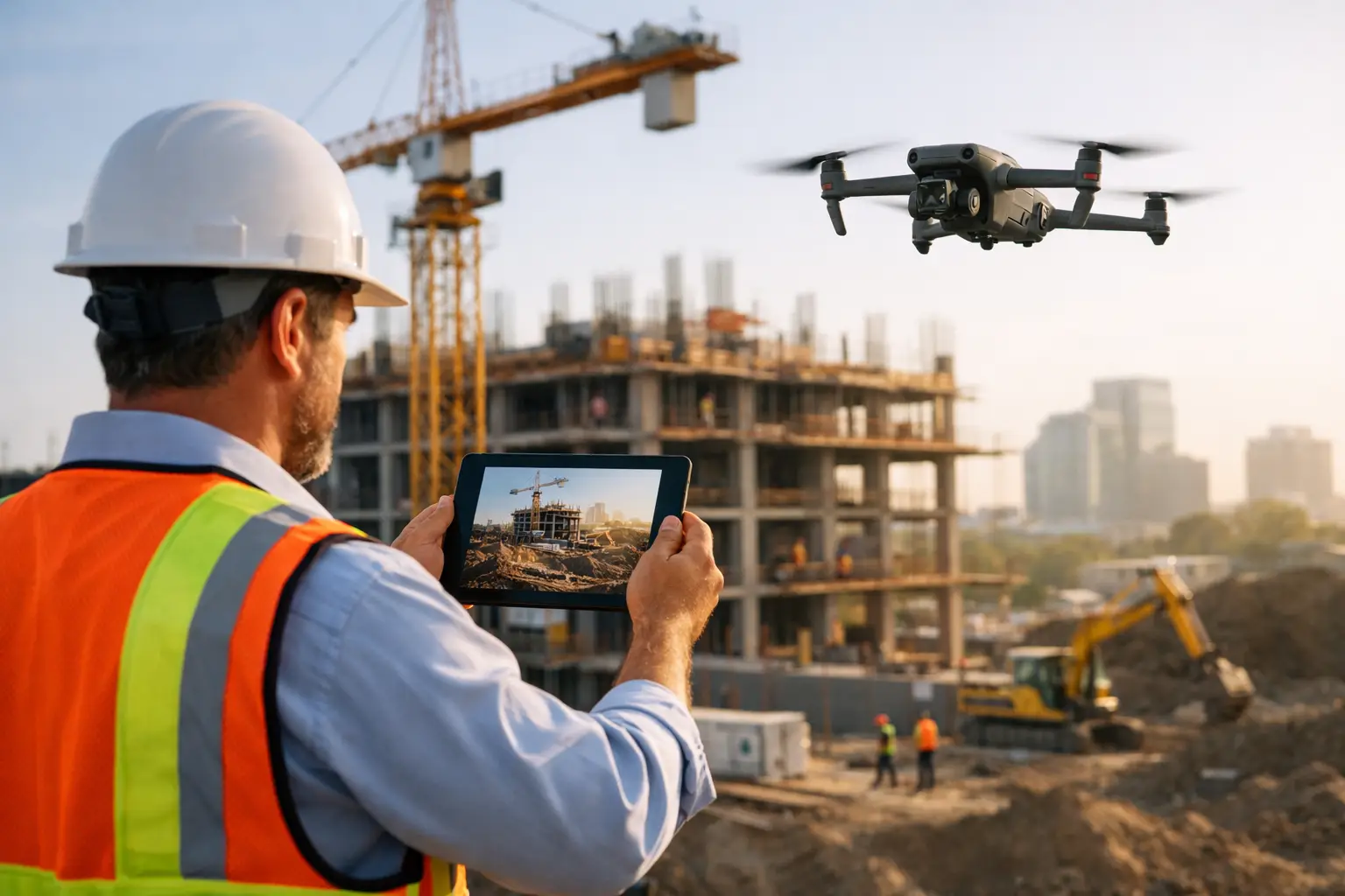
The strongest use cases are usually the ones where manual access is slow, risky, or costly. Large job sites are a clear example. A superintendent may need regular progress documentation across a broad footprint, and walking the entire site every time is not efficient. Aerial mapping gives the team a current, measurable view of conditions that can be reviewed from the office and shared across project stakeholders.
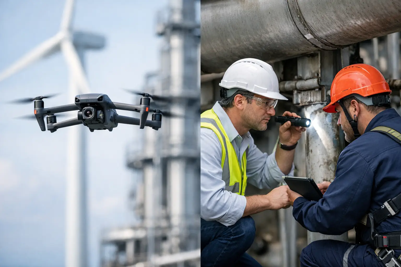
In utilities and energy environments, access challenges are even more obvious. Substations, transmission corridors, plant structures, and elevated assets often require coordination, safety controls, and specialized personnel. Drone-based inspection support does not replace qualified engineers or technicians, but it can reduce unnecessary exposure and help teams focus on areas that need closer review.
Telecom infrastructure is another strong fit. Cell towers and rooftop communication assets often demand current visual documentation before maintenance, modification, or insurance review. Drone imagery can help teams assess external conditions, verify equipment locations, and plan work more efficiently.
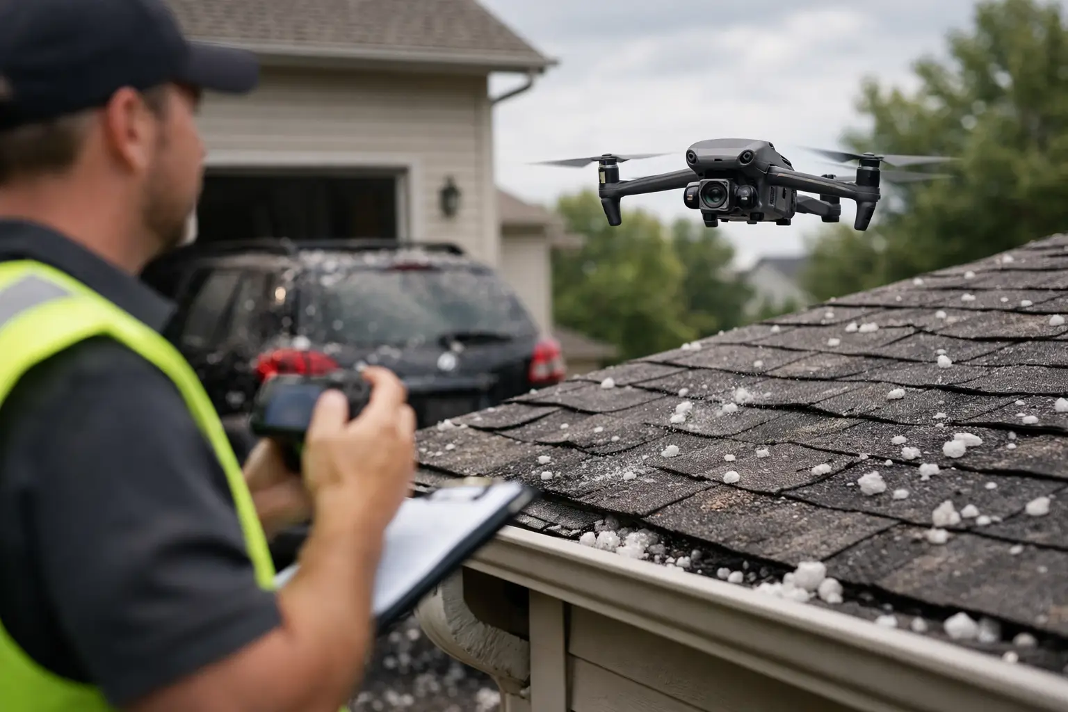
Insurance and catastrophe response also benefit from speed. After severe weather, decision-makers need documentation across multiple locations fast. Industrial drone services can help capture the condition of commercial buildings, infrastructure, and affected sites while access is still difficult and timelines are compressed.
Why safety is one of the biggest business benefits
The discussion often starts with speed or cost, but safety is usually the bigger reason these services make sense. When a team can inspect elevated, confined, unstable, or hard-to-reach areas from a distance, that changes the risk profile of the job.
That does not mean drones remove all field risk. Flights still require planning, airspace review, weather assessment, site coordination, and disciplined operations. But compared with climbing structures, setting up lifts, or putting more people near energized or damaged assets, drone-based workflows can reduce exposure in a meaningful way.
For asset owners and project leaders, that matters beyond safety metrics. Lower exposure often means fewer delays, less disruption to operations, and a more efficient path to the information the team actually needs.
Industrial drone services for inspections and documentation
Inspection support is where many organizations see the clearest return. A manual inspection may require multiple people, temporary access equipment, outage coordination, or partial shutdowns. A drone mission can often capture a broad visual record much faster.
That speed has practical value, but only if the documentation is organized properly. Decision-makers do not need a folder full of random photos. They need a clear visual record tied to the asset, date, location, and purpose of the job. They need imagery that helps maintenance teams flag issues, engineering teams review conditions, and insurance personnel document damage consistently.
There is also an important trade-off here. Not every asset or condition can be evaluated fully from aerial imagery alone. Drones are excellent for visual documentation, mapping, thermal screening, and locating apparent issues. They are not a substitute for hands-on testing, engineering judgment, or formal certification. The best use of drone data is to support those workflows, not overstate what remote imagery can prove.
Mapping, modeling, and progress tracking
Construction and infrastructure teams often need more than inspection photos. They need a current, measurable view of the site. That is where orthomosaic mapping and 3D modeling become useful.
An orthomosaic map gives project teams a high-resolution overhead image that is corrected for scale and perspective. That makes it useful for tracking site progress, documenting conditions, reviewing access routes, and improving communication between field and office teams. A 3D model adds another layer when grade changes, structure development, or complex site geometry matter.
These deliverables can improve project management, but expectations should stay grounded. The quality of mapping output depends on flight planning, site conditions, control practices, and the intended use of the data. For one project, a general progress map may be enough. For another, teams may need tighter alignment with survey or engineering workflows. It depends on the decisions the data is meant to support.
What separates a professional provider from a basic operator
This is where many buyers make the wrong comparison. Industrial work is not the same as hiring someone to capture aerial footage. Complex commercial and infrastructure sites require more than basic piloting.
A qualified provider should bring FAA Part 107 certification, appropriate insurance coverage, strong safety discipline, and experience working around active industrial environments. They should understand how to coordinate with site contacts, operate within project constraints, manage data capture systematically, and deliver files in a format that supports operations.
Field judgment also matters. Weather, electromagnetic interference, access restrictions, nearby structures, and active work zones all affect how a mission should be planned. In demanding environments, professionalism shows up in preparation and execution, not just in the final imagery.
That is one reason organizations across Georgia and the broader Southeast often look for a drone partner with proven industrial field experience rather than a generalist. The cost of poor documentation, unsafe practices, or incomplete data is usually far higher than the price difference between providers.
How to evaluate industrial drone services before hiring
Start with the business problem, not the aircraft. If your team needs recurring construction documentation, the right provider should be able to explain how often flights should occur, what deliverables will be produced, and how the output will support reporting and coordination. If the need is inspection support, ask how imagery will be organized, what thermal or visual methods are appropriate, and where the limits of drone-collected data begin.
It is also worth asking about deployment readiness. Some projects are planned weeks ahead. Others follow a storm event, equipment issue, or urgent inspection need. A provider built for commercial and industrial operations should be able to communicate clearly about scheduling, site requirements, safety planning, and turnaround times.
Finally, review examples of deliverables, not just highlight reels. The question is not whether the images look impressive. The question is whether the data will help your team make a decision, document a condition, support a claim, or plan the next step with less guesswork.
The best industrial drone services do not sell the flight as the product. They provide reliable aerial intelligence that fits the realities of construction, infrastructure, insurance, and industrial operations. When the work is done right, your team gets clearer visibility, less field exposure, and documentation that holds up when schedules are tight and the stakes are high. If that sounds like the kind of support your operation needs, it is worth choosing a provider built for serious field work from the start.