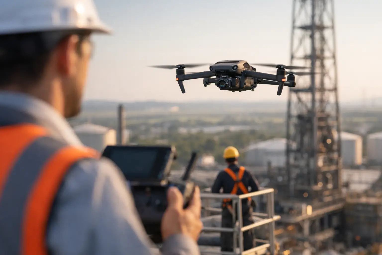
A corroded stack, a damaged roof section, a transmission structure after a storm – these are the kinds of inspection scenarios where risk compounds fast. The longer a team spends climbing, rigging, shutting down equipment, or entering difficult areas, the more exposure the operation carries. That is exactly why more industrial and infrastructure teams are evaluating how drones reduce inspection risk as part of a broader safety and documentation strategy.
For many assets, the biggest safety gain is simple: fewer people have to go into the hazard zone just to get eyes on the problem. Instead of sending personnel up a tower, onto a fragile roof, near energized components, or into a hard-to-access exterior area, a drone can capture high-resolution imagery and video from a safer standoff position. That does not eliminate all inspection risk, and it does not replace engineering judgment, but it can remove a large portion of unnecessary exposure early in the process.
How drones reduce inspection risk in the field
Traditional inspection methods often require physical access before a team even knows the condition of the asset. That means ladders, lifts, rope access, scaffolding, shutdown coordination, confined approach planning, or extended time working at height. Each step introduces another layer of operational and safety complexity.
A professional drone workflow changes that sequence. The aircraft is deployed first to gather visual data, thermal imagery when appropriate, or broad-area documentation that helps teams understand what they are dealing with before deciding on the next step. In practical terms, this reduces blind climbs, cuts down repeated site entries, and helps maintenance, operations, engineering, and insurance teams prioritize where hands-on inspection is actually needed.
That distinction matters. Drone inspections are most valuable when they reduce exposure to routine access hazards while improving the quality of the information available to decision-makers. If an issue appears minor, the organization may avoid a larger manual inspection event. If the imagery shows significant damage or clear anomalies, teams can plan a targeted follow-up with better awareness and tighter controls.
The main risks drones help reduce
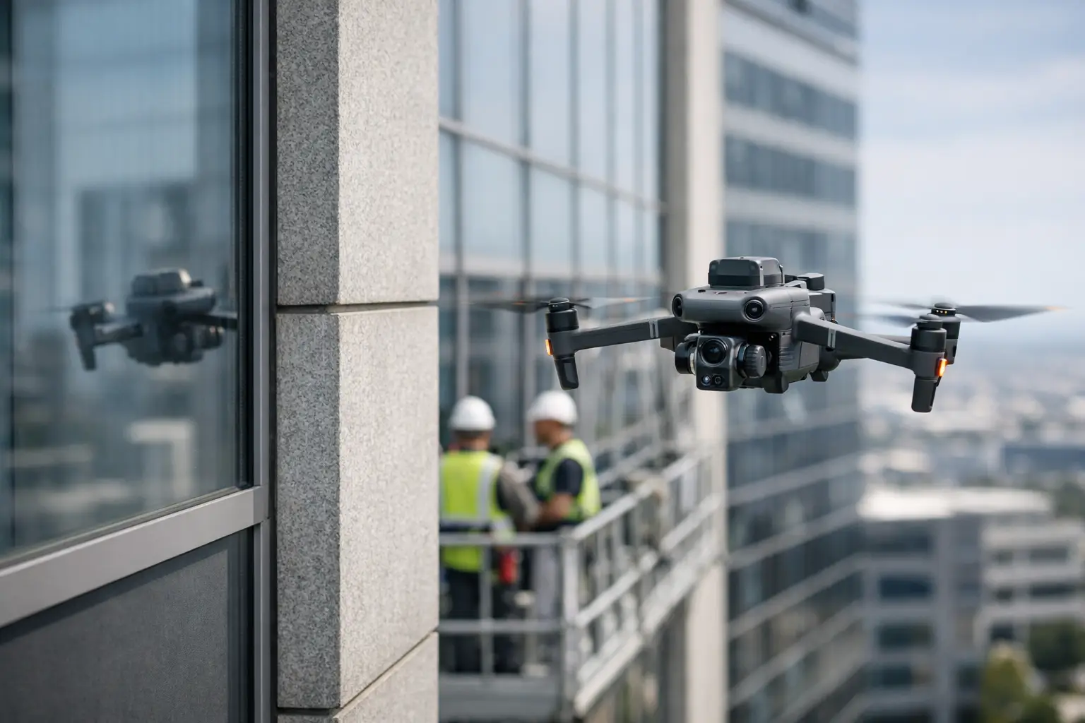
The most obvious category is fall risk. Towers, elevated structures, industrial rooftops, flare stacks, cooling towers, and exterior plant components often require personnel to work at height or near difficult edges. Even with proper safety protocols, those environments carry exposure that can be minimized when aerial data is collected remotely.
The second category is access risk. Some assets are not especially high, but they are awkward, congested, or located in areas where getting close introduces hazards. Substations, pipe racks, steep embankments, storm-damaged structures, and large active construction sites all create access challenges. A drone can often document the asset without forcing personnel into unstable footing, traffic conflicts, or equipment-heavy work zones.
There is also a time-related risk factor. The longer an inspection takes, the longer people remain exposed to the environment. Heat, weather, fatigue, active operations, and repetitive climbing all increase risk over time. Faster aerial collection can shorten the window of exposure, especially during preliminary assessments, post-storm documentation, and recurring condition checks.
Then there is the risk of incomplete visibility. Manual inspections sometimes provide a close look at one area but leave gaps elsewhere because access is difficult, expensive, or time-consuming. Drones can improve coverage across roofs, façades, towers, cooling structures, and long linear assets such as pipelines or transmission corridors. Better visibility does not just improve reporting. It helps teams avoid making decisions from partial information.
Where the safety value is strongest
Cell towers are a clear example. A conventional inspection may require a climb team to reach elevation before anyone can verify bolt conditions, antenna mounting concerns, corrosion, or visible damage. Drone-based imagery can support a first-pass assessment from the ground, helping determine whether a climb is necessary and where attention should be focused.
In power generation and industrial facilities, exterior assets often involve heat, restricted access zones, congested infrastructure, and operational coordination. Aerial inspections can support roof reviews, elevated exterior checks, stack and cooling structure documentation, and thermal scans of selected components where conditions and permissions allow. The value is not just that the aircraft can get close. It is that the facility can often gather actionable visual intelligence with less disruption and fewer personnel near the hazard area.
Construction sites benefit for a different reason. Risk on active projects comes from constant change. Crews, equipment, materials, and temporary conditions shift daily. Drone documentation helps project teams inspect elevated work, façades, roof progress, and site conditions without sending additional personnel repeatedly into active zones. It also creates a current visual record that can support safety planning, subcontractor coordination, and dispute resolution.
After severe weather, the risk picture changes again. Damage may include loose materials, compromised structures, hidden water intrusion, and unstable surfaces. In those moments, the first priority is often situational awareness. Drone flights can help insurers, facility teams, and catastrophe-response coordinators document losses quickly without rushing people onto compromised roofs or into unsafe perimeter areas before conditions are understood.
Why better data also lowers risk
Safety is not only about keeping people out of dangerous places. It is also about making better decisions once the data is collected.
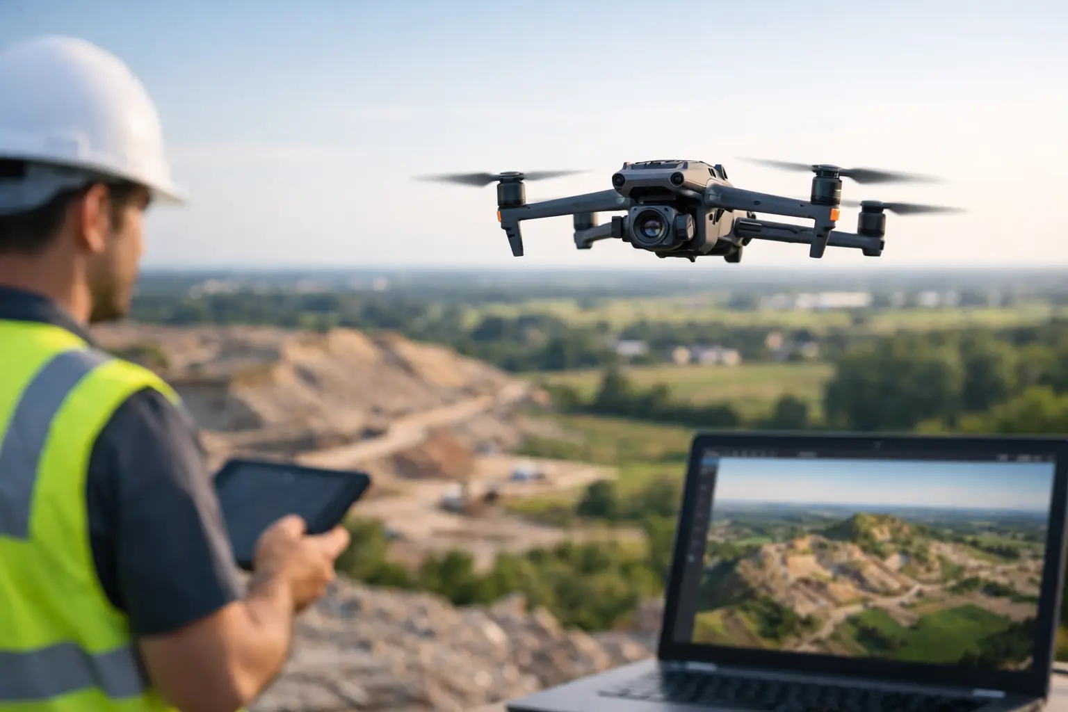
High-resolution imagery, thermal data, orthomosaic maps, and 3D models give operations and engineering teams a clearer basis for planning. They can review conditions off-site, share findings across departments, compare changes over time, and identify exactly where additional inspection or maintenance resources should be deployed. That reduces guesswork, and guesswork is often where risk starts.
This is one reason professional drone inspection support is different from basic aerial photography. The point is not to get impressive visuals. The point is to capture usable documentation that supports maintenance triage, project oversight, claims handling, or follow-up inspection planning. For decision-makers managing expensive assets and tight schedules, that distinction matters.
The trade-offs decision-makers should understand
Drones reduce risk, but they do not remove every constraint. Weather can limit flight operations. Site conditions, airspace, electromagnetic interference, and operational restrictions can affect what is possible on a given day. Some environments still require manual inspection, shutdown planning, or specialty access methods to verify conditions at close range.
There is also a difference between identifying visible issues and diagnosing root cause. A drone can document cracking, corrosion, missing components, thermal anomalies, water intrusion indicators, or storm damage patterns. It cannot certify structural integrity or replace a licensed engineer, inspector, or technical specialist. The best use case is often as a force multiplier – reducing unnecessary exposure, improving documentation quality, and helping experts focus their time where it counts.
That is why field discipline matters. Commercial and industrial clients need more than someone who can fly a drone. They need a provider that understands controlled operations, airspace compliance, documentation standards, and the realities of working around active infrastructure. FAA Part 107 certification, proper insurance coverage, and experience in demanding environments are not side notes. They are part of risk reduction.
How to get the most value from a drone inspection program
The strongest results usually come when drone data is built into the inspection workflow rather than treated as a one-off add-on. Start with the question the team needs answered. Is the goal to determine whether a climb is necessary, document storm damage, monitor changing site conditions, review roof integrity indicators, or support engineering follow-up? The clearer the objective, the more useful the data set will be.
It also helps to define what deliverables are needed before deployment. Some teams need high-resolution stills for maintenance records. Others need thermal imagery, orthomosaic mapping, or repeatable progress documentation that can be compared over time. Matching the collection method to the operational decision is where the return improves.
For organizations managing facilities or projects across Georgia, Alabama, South Carolina, or Tennessee, response time and field readiness can make a real difference when weather events, outage windows, or active construction schedules compress the timeline. A prepared drone services partner can help teams gather documentation quickly without lowering the bar on safety or professionalism.
Air Reel Technologies operates in that space with a practical focus on inspection support, aerial data collection, and disciplined field execution for commercial, industrial, and infrastructure environments.
The strongest case for drones is not novelty. It is exposure reduction backed by better information. When teams can inspect smarter, limit unnecessary access, and plan next steps from reliable visual data, risk starts moving in the right direction. That is a better place to make any critical decision.