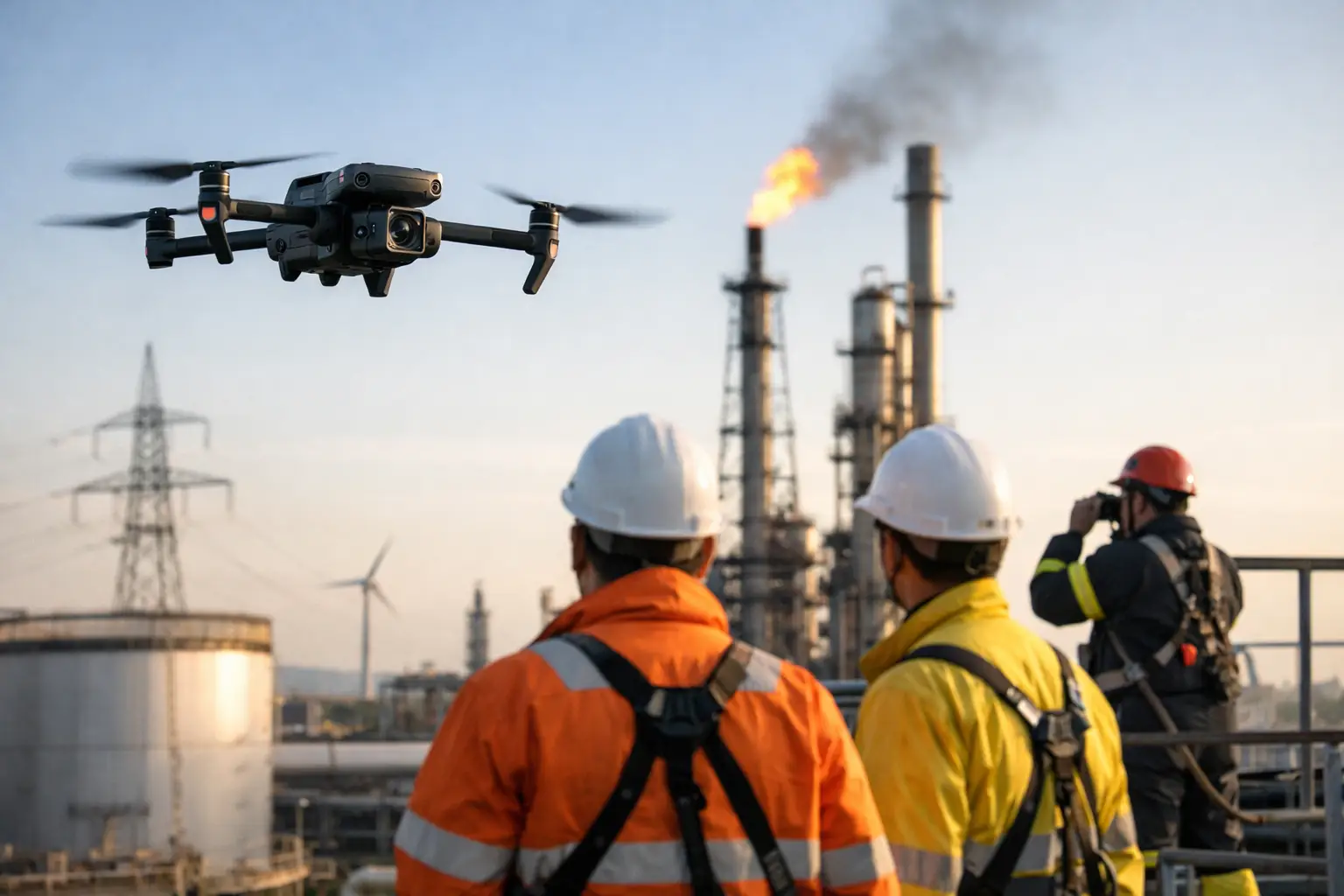
A grading contractor needs topographic data before earthwork starts. A utility team needs visibility along a wooded corridor. An owner’s rep wants clean progress documentation for a multi-phase build. Those requests sound similar on paper, but the right capture method can be very different. When teams compare drone mapping vs lidar, the real question is not which technology is better overall. It is which one produces the right data for the asset, the environment, and the decision that has to be made.
For commercial and industrial operations, that distinction matters. The wrong method can create delays, drive up processing costs, or leave gaps in the data. The right method can reduce field time, improve visibility, and support safer planning in places where manual data collection is slow or risky.
Drone mapping vs lidar: the core difference
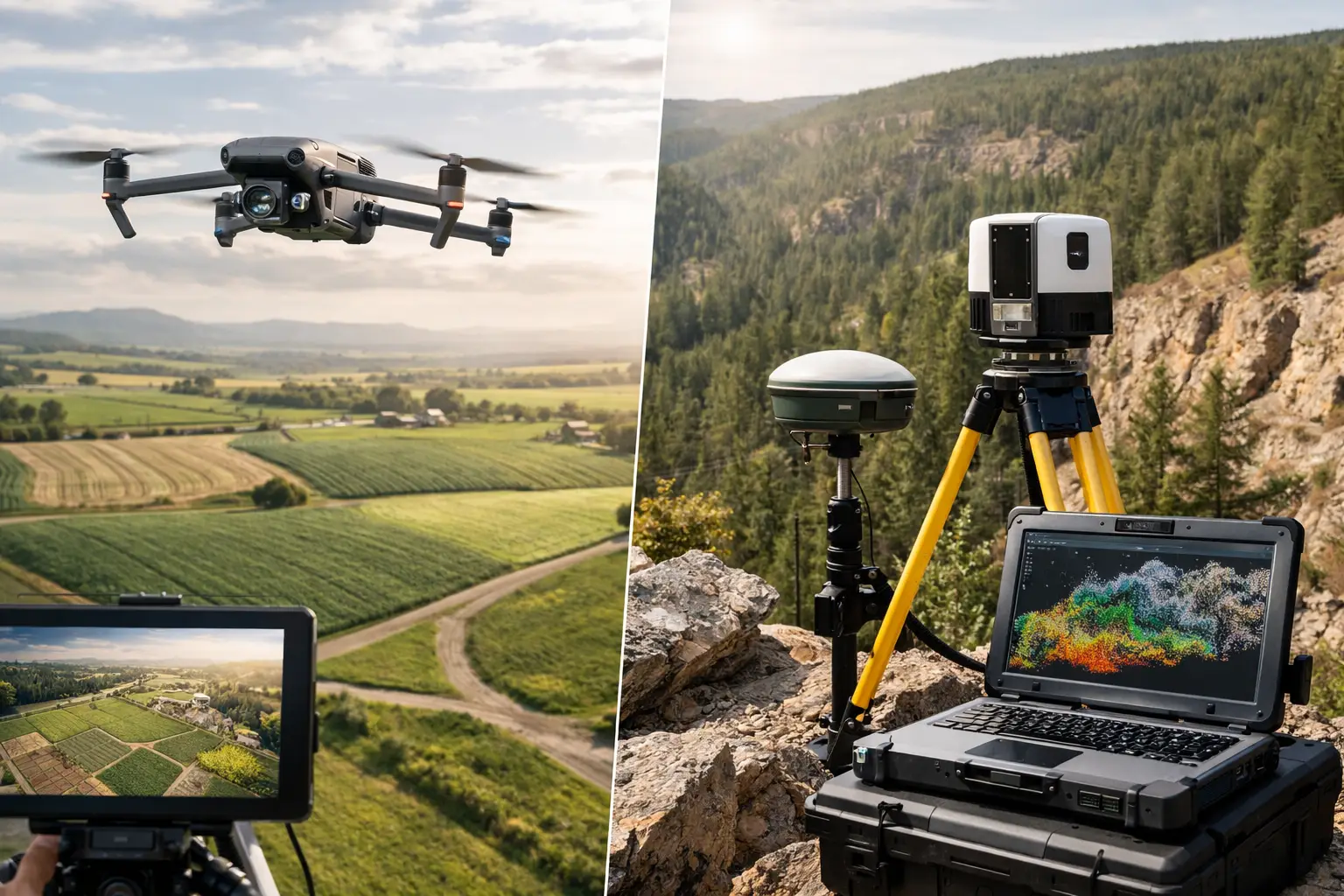
Standard drone mapping usually relies on high-resolution photos captured in a planned flight pattern. Those images are processed into deliverables such as orthomosaics, point clouds, elevation models, and 3D reconstructions. This method is often called photogrammetry. It works by identifying common points across many overlapping images and using them to build an accurate model of the site.
LiDAR works differently. Instead of depending on imagery alone, it uses laser pulses to measure distances to surfaces. The result is a dense set of spatial points that can represent terrain, structures, vegetation, and other objects with a high degree of positional consistency.
That difference shapes everything downstream. Photogrammetry gives you rich visual detail and performs very well when the site is open, visible, and well lit. LiDAR is stronger when you need reliable geometry in complex terrain, around vertical structures, or under partial vegetation cover.
When drone mapping is the better choice
For many construction and documentation projects, drone mapping is the practical answer. If the goal is to create an orthomosaic for site tracking, generate a visual surface model, document stockpiles, or provide clear progress imagery for stakeholders, photogrammetry is often more than sufficient.
It also carries an advantage that matters to project managers and owners – the outputs are easy to interpret. High-resolution imagery shows site conditions in a familiar way. Superintendents can review access roads, material laydown areas, drainage paths, roof conditions, and staging changes without translating raw technical data into plain language first.
On active construction sites, this visual clarity is useful. Teams may need weekly or monthly updates that show where work stands, support pay applications, or help resolve disputes about sequence and site conditions. Drone mapping handles those workflows well because it combines spatial context with recognizable imagery.
Costs can also be more favorable, especially for routine site capture. Equipment and processing requirements are generally lower than LiDAR, which makes photogrammetry a strong fit when the site is relatively open and the deliverable does not depend on penetrating canopy or resolving difficult geometry.
That said, drone mapping has limits. Dense vegetation, reflective surfaces, repetitive textures, shadow-heavy areas, and poor lighting can all reduce data quality. If the ground is hidden, photogrammetry usually cannot solve that problem.
When LiDAR earns its place
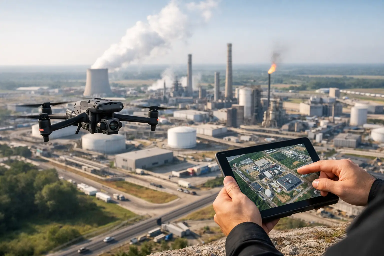
LiDAR becomes valuable when the site conditions are working against image-based mapping. Utility corridors, wooded parcels, pipeline routes, industrial campuses with vertical complexity, and terrain hidden by brush are common examples.
If your engineering team needs a clearer understanding of bare earth beneath light to moderate vegetation, LiDAR may be the better tool. Laser returns can reach through gaps in foliage in ways standard imagery cannot. That makes a significant difference in topographic work, drainage analysis, route planning, and pre-construction evaluation where the actual ground surface matters more than the visible tree canopy.
LiDAR also performs well around structures with complex geometry. Facilities with tanks, pipe racks, towers, containment features, and layered elevations can challenge photogrammetry, particularly where sight lines are inconsistent. LiDAR can produce more dependable spatial data in those environments.
This does not mean LiDAR is automatically the premium answer for every project. It often comes with higher acquisition costs, more specialized workflows, and deliverables that may require more interpretation. If a client primarily needs visual documentation for operations, claims support, or progress reporting, LiDAR may add cost without adding meaningful value.
Accuracy is not a one-word answer
One of the most common mistakes in the drone mapping vs lidar debate is treating accuracy as a simple winner-take-all category. In practice, accuracy depends on flight planning, control points, sensor quality, site conditions, processing methods, and the type of accuracy the project actually requires.
Photogrammetry can produce very accurate results on open sites when the mission is properly planned and controlled. For many construction applications, that level of accuracy is fully appropriate. LiDAR can offer advantages in consistency across difficult terrain and complex surfaces, but the result still depends on execution.
Decision-makers should ask a more useful question: accurate for what purpose? A monthly orthomosaic to monitor grading progress does not carry the same requirement as a terrain model for design planning through a wooded corridor. If the deliverable is tied to engineering, quantity calculations, or terrain analysis, the capture method should match that use case from the start.
Deliverables should drive the method
The fastest way to choose between drone mapping and LiDAR is to start with the end product. If the team needs a clean orthomosaic, progress visuals, surface model, or 3D site context built from imagery, drone mapping is often the right fit. If the team needs a denser terrain-focused dataset in vegetated or structurally complex conditions, LiDAR may be the better investment.
This is especially true for industrial and critical infrastructure environments, where field access may be limited and repeat visits are expensive. Capturing the wrong data on the first mobilization can create avoidable schedule pressure. That is why experienced operators focus on the decision the client has to make, not just the sensor being flown.
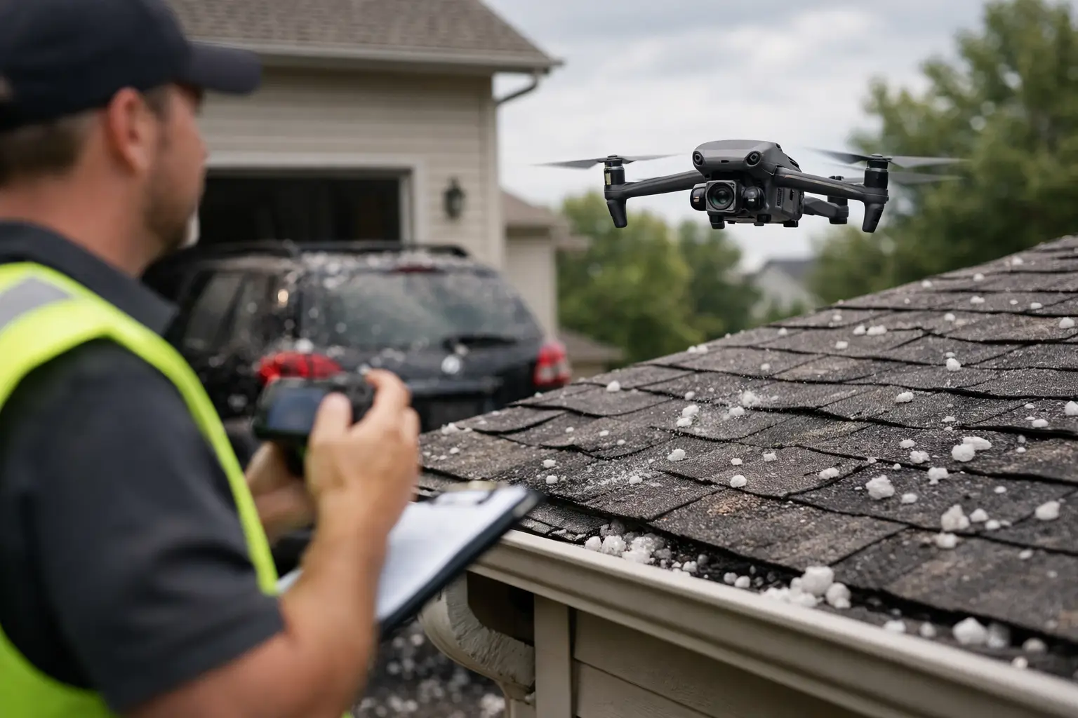
For example, a roofing portfolio assessment may benefit more from high-resolution image capture and thermal data than from LiDAR. A substation expansion site with heavy grade analysis needs may require a different approach. A transmission corridor with canopy interference is another case entirely. The technology should follow the operational objective.
Drone mapping vs lidar for construction and infrastructure
In construction, drone mapping is often the better day-to-day tool. It supports progress monitoring, owner reporting, planning meetings, stockpile measurement, and broad site visibility with a relatively efficient workflow. For teams managing schedules, subcontractor coordination, and changing site conditions, those deliverables are immediately useful.
In infrastructure work, the answer is more mixed. Facilities and corridors often include exactly the kinds of obstacles that expose the limits of image-based capture. Vegetation, elevation changes, restricted ground access, and vertical assets can make LiDAR a stronger option for certain scopes.
That does not mean every infrastructure project needs LiDAR. It means the environment deserves a closer look before choosing the method. In many cases, a blended strategy is the best answer. Imagery may support documentation and condition review, while LiDAR supports terrain modeling or spatial analysis where visuals alone fall short.
For organizations operating across Georgia, Alabama, South Carolina, and Tennessee, that flexibility matters. Terrain, vegetation, weather, and asset type can vary significantly across service areas, and field conditions should shape capture planning.
Cost, speed, and operational fit
Budget always matters, but lowest capture cost is not the same as lowest project cost. If photogrammetry is cheaper upfront but fails to produce the terrain visibility an engineering team needs, the savings disappear quickly. The same applies in reverse. If LiDAR is specified for a straightforward progress documentation mission, the project may be paying for capability it does not need.
Speed is similar. Drone mapping can be very efficient for routine site documentation, especially when repeatable flight plans are part of an ongoing workflow. LiDAR can reduce uncertainty in difficult environments, but processing and interpretation may be more involved depending on the deliverable.
The best choice usually comes from balancing three factors: what the site allows, what the team needs to see, and how the data will be used after capture. When those factors are aligned, both methods can be highly effective.
The right question to ask before choosing
Instead of asking whether drone mapping or LiDAR is better, ask what decision the data needs to support. Are you tracking construction progress, estimating quantities, reviewing drainage paths, documenting claim conditions, planning work around vegetation, or evaluating a corridor with limited ground access? Each of those goals points toward a different capture strategy.
That is where a field-tested drone services partner adds value. The job is not to push one sensor over another. It is to understand the asset, the environment, the safety considerations, and the deliverable requirements before mobilization begins.
For high-value commercial, industrial, and infrastructure projects, the best data collection plan is usually the one built around the mission, not the hardware. Choose the method that helps your team act with confidence, and the project tends to move faster from there.