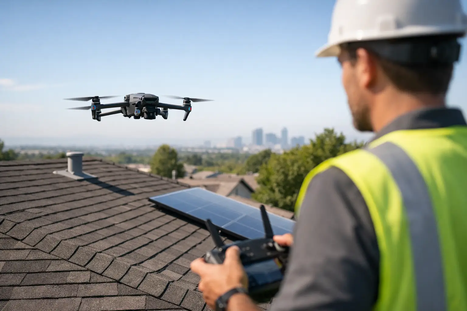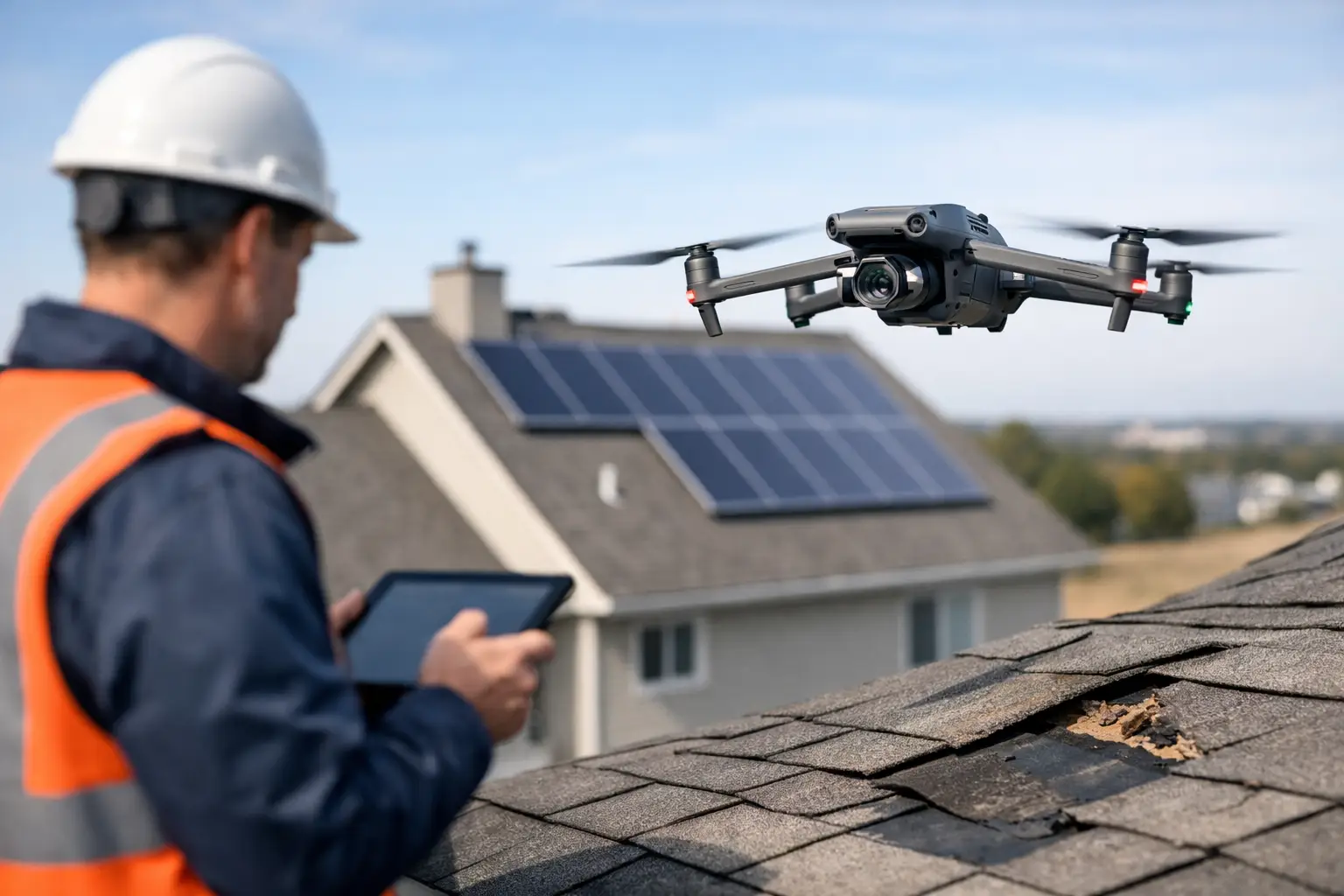
A roof that looked acceptable in a satellite image can tell a very different story at 80 feet with a stabilized camera and a structured flight plan. For underwriting teams evaluating commercial properties, industrial sites, and complex facilities, drone data for underwriting inspections gives a clearer view of condition, exposure, and documentation quality before a policy is written or renewed.
That matters because underwriting is rarely slowed down by a lack of paperwork. It is slowed down by uncertainty. When the asset is large, elevated, difficult to access, or spread across multiple structures, traditional site review can become inconsistent, expensive, or incomplete. Drone-based inspection support helps close that gap with current visual evidence, repeatable capture methods, and safer field collection.
Why drone data fits underwriting work
Underwriting decisions depend on accurate risk visibility. On many commercial and industrial properties, the areas that matter most are also the hardest to inspect well from the ground. Roof systems, drainage paths, exterior wall conditions, rooftop equipment, storm damage indicators, vegetation encroachment, access constraints, and neighboring exposures are often only partially visible during a standard visit.
Drone operations give underwriters and inspection vendors a way to document those conditions without sending personnel onto steep roofs, around fragile surfaces, or into active operational zones unnecessarily. A well-executed mission can capture high-resolution imagery of the building envelope, site layout, surrounding risk factors, and visible maintenance issues in a fraction of the time required for more labor-intensive methods.
For carriers and MGAs working on tight turnaround times, speed matters. But speed only helps if the result is usable. The value of drone data is not simply that it is aerial. The value is that it can be captured systematically, labeled clearly, and delivered in a form that supports underwriting review instead of creating more interpretation work.
What underwriters can actually learn from drone data for underwriting inspections
The strongest use of drone data for underwriting inspections is not replacing engineering judgment or formal loss-control analysis. It is improving the quality of field documentation that supports those functions.
On roof-heavy commercial risks, aerial imagery can reveal ponding areas, membrane wear, punctures, seam issues, flashing concerns, debris accumulation, drainage limitations, and evidence of deferred maintenance. On industrial facilities, it can help document rooftop mechanical units, stack penetrations, cooling structures, access points, and general site organization. On larger campuses, it can show proximity hazards, surface conditions, perimeter issues, and exposure relationships that are hard to understand from ground photography alone.
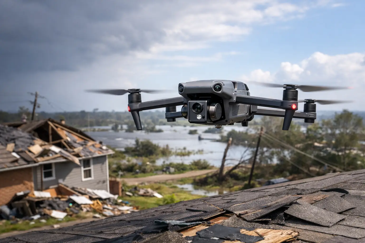
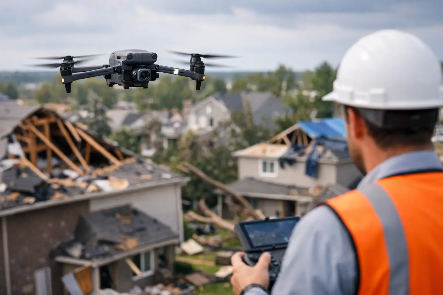
For post-storm underwriting reviews or renewals in catastrophe-prone regions, drones can also support rapid condition checks when timing matters. A carrier may need updated imagery to evaluate whether a property has visible storm-related damage, temporary repairs, or open issues that affect renewal terms. In those situations, current aerial documentation can be far more useful than outdated file photos or incomplete on-site notes.
The key is discipline in collection. Random flyover footage has limited underwriting value. Structured capture plans, consistent image angles, close-up condition shots, wide context images, and organized deliverables are what make the data useful.
Where drone inspections work best – and where they do not
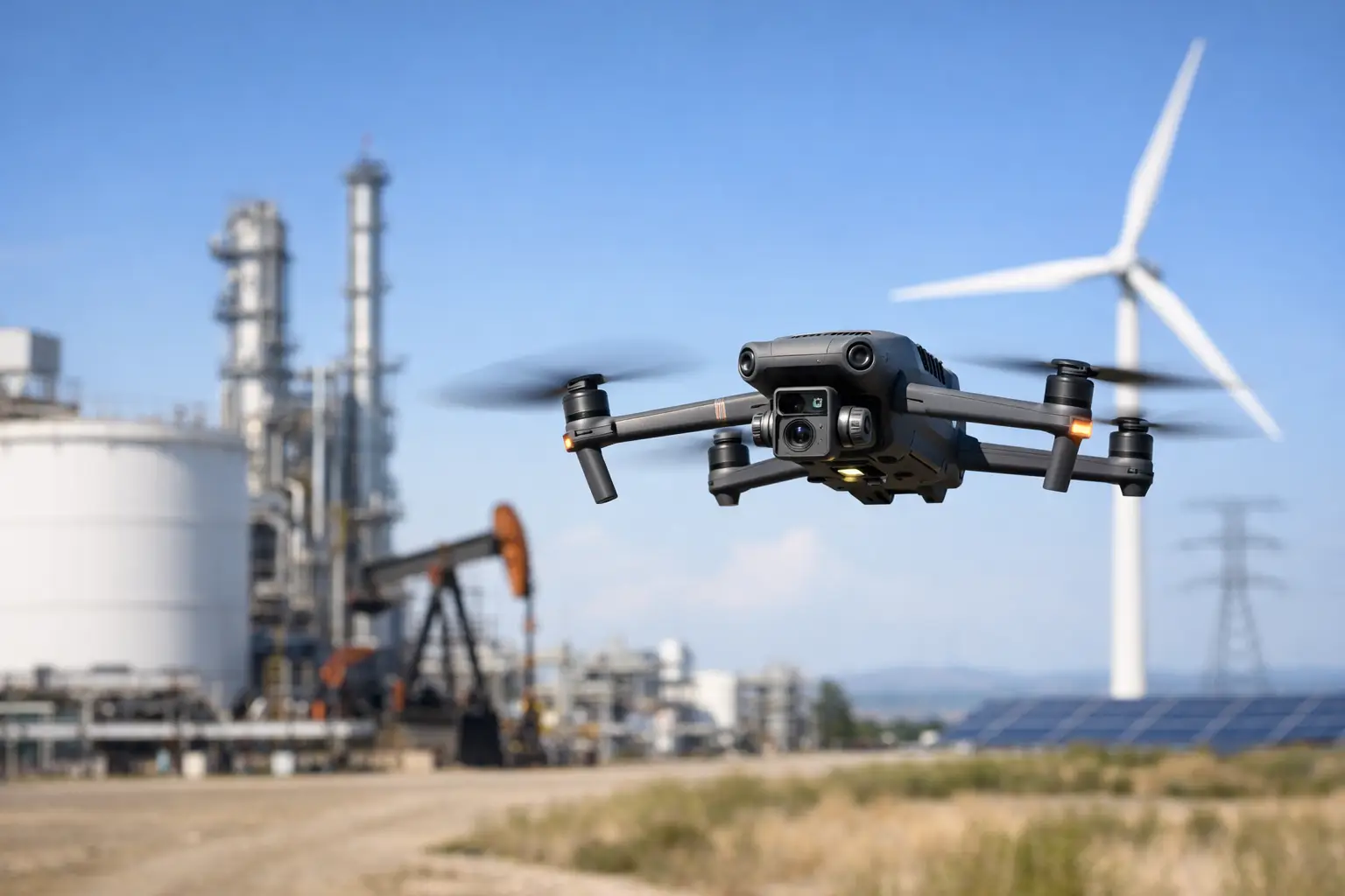
Drone support is especially effective on large commercial roofs, industrial properties, multifamily portfolios, warehouses, manufacturing campuses, energy-related facilities, telecom assets, and locations with limited safe roof access. It is also useful when an underwriting team needs documentation across multiple structures and wants a repeatable process from one site to the next.
There are limits. Drones do not see through materials, they do not confirm code compliance, and they do not determine structural integrity. They also may not resolve every underwriting question at every location. Interior conditions, concealed damage, certain installation defects, and some occupancy-specific concerns still require in-person review by the appropriate professionals.
Weather, airspace restrictions, facility rules, and operational safety conditions can also affect what is possible on a given day. That is one reason experienced field execution matters. In underwriting support, missed flights and incomplete data are more than an inconvenience. They delay decisions.
Better documentation leads to better underwriting consistency
A common underwriting problem is not just missing information. It is uneven information. One property file may include strong roof photos and a clear site overview, while another includes a few ground-level images and vague notes. That inconsistency makes portfolio-level review harder and can lead to avoidable friction between underwriting, inspection vendors, brokers, and insureds.
Drone-based inspection support can improve consistency by standardizing how exterior conditions are captured. Instead of relying on whatever can be seen from a ladder, parking lot, or adjacent access point, the inspection workflow can follow a repeatable pattern across locations. That helps underwriters compare conditions more confidently across similar asset types.
It also helps when accounts move through renewal cycles. If imagery is collected in a consistent way over time, teams can more easily identify visible changes in roof condition, maintenance progress, equipment additions, site clutter, drainage issues, and other external factors that may affect risk evaluation.
The operational advantages are hard to ignore
For large properties and difficult environments, traditional inspection methods can introduce delay, cost, and safety exposure. Roof access may require escorts, special coordination, or temporary work stoppages. Some surfaces are unsafe to walk. Some sites remain active during business operations, making foot-based inspection impractical.
Drone collection reduces the need for unnecessary physical access while still producing current visual documentation. That can shorten field time, reduce disruption for the insured, and help inspection vendors complete more assignments efficiently. On high-volume underwriting programs, those gains are not minor. They affect service levels, turnaround times, and overall file quality.
This is particularly relevant for catastrophe response and regional weather events. After a hailstorm, wind event, or hurricane impact, underwriting and claims-related teams may need rapid exterior documentation across multiple properties. A mission-ready drone provider can support that need with faster deployment and more scalable site capture than many manual approaches.
What to look for in a drone partner for underwriting inspections
Not every drone operator is built for underwriting support. The work calls for more than flight skills. It requires disciplined data capture, understanding of documentation needs, and the ability to operate professionally around commercial and industrial assets.
FAA Part 107 certification is the baseline, not the differentiator. Carriers and inspection firms should also look for proper insurance coverage, experience in complex field environments, and a track record of producing inspection-grade deliverables rather than promotional footage. Image quality matters, but so do labeling, organization, mission planning, safety procedures, and responsiveness.
Experience with industrial sites, large facilities, and post-event documentation is especially valuable. Underwriting inspections often involve time pressure, access constraints, and stakeholders who need reliable information without delays or guesswork. A provider that understands those conditions will usually produce better results than one focused on general aerial media work.
In markets across Georgia, Alabama, South Carolina, and Tennessee, that local and regional readiness can also matter. Weather windows can be narrow, and travel logistics can slow response times if the provider is not equipped to work efficiently in the territory.
Using drone data without overreaching
The best underwriting teams use drone data as decision support, not as a stand-alone answer to every risk question. That distinction matters. High-resolution imagery can show a great deal, but it still needs context. Visible roof wear may indicate deferred maintenance, or it may reflect age without immediate functional failure. Surface staining may suggest drainage concerns, but follow-up may still be needed.
That is why drone documentation works best when it fits into a broader underwriting process that may include applications, prior loss history, engineering input, inspection reports, and account-specific risk guidelines. The drone data strengthens the file. It does not replace underwriting judgment.
Handled correctly, though, it can remove a surprising amount of ambiguity. It helps carriers see what they are insuring, document what they observed, and move faster when conditions on site would otherwise slow the process down.
For underwriting teams responsible for complex commercial and industrial risks, that is the real advantage. Better visibility leads to better questions, cleaner files, and decisions made with fewer blind spots. And when field documentation needs to be fast, safe, and dependable, a disciplined drone operation is not a novelty. It is a practical inspection asset.