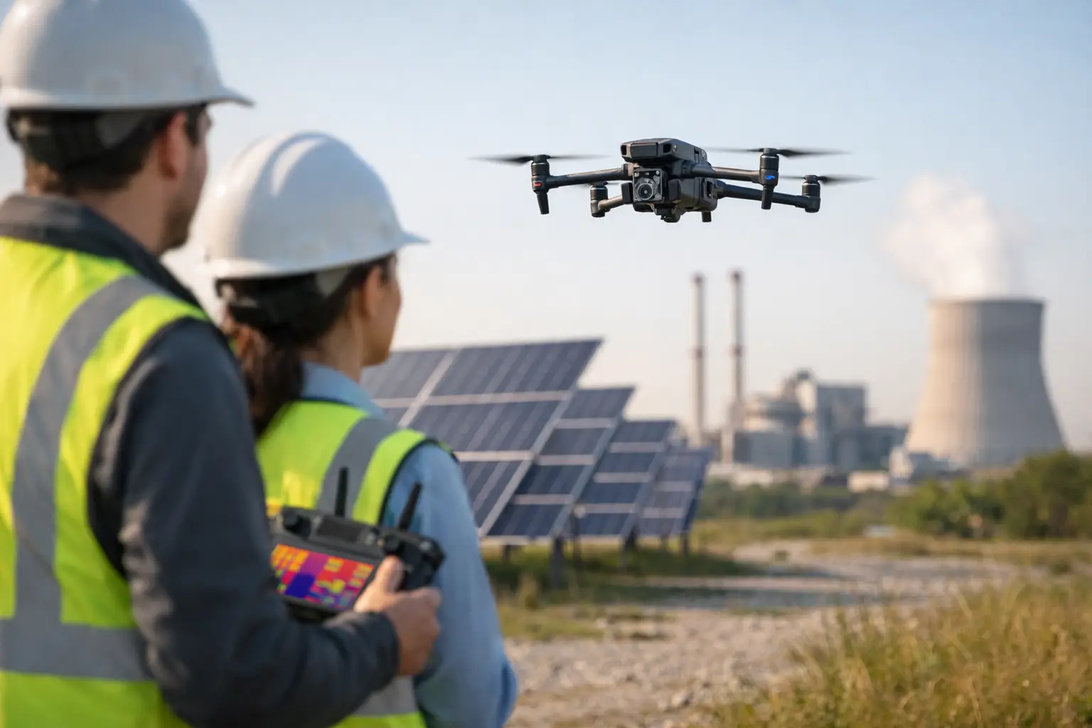
A thermal image taken at the wrong time of day can send a maintenance team chasing a problem that is not actually there. A thermal image captured under the right conditions can show heat loss, moisture intrusion, overloaded components, or failing equipment before those issues become a shutdown, a claim, or a costly repair. That is the difference in how to use drone thermography well – not just flying a thermal camera, but collecting data that holds up in real operations.
For commercial and industrial teams, drone thermography works best when it is treated as an inspection support tool, not a gadget. The value comes from safer access, broader coverage, and repeatable documentation across assets that are hard to reach, hazardous to climb, or too large to inspect efficiently from the ground. Roofing systems, substations, solar arrays, plant equipment, building envelopes, and transmission assets all benefit, but only when the mission is planned around the asset, the environment, and the decision that needs to be made after the flight.
How to use drone thermography for real inspections
The first step is defining what the thermal data needs to answer. A roof scan looking for trapped moisture is a different mission than a substation survey checking for abnormal heat signatures, and both are different from a solar inspection focused on underperforming modules or connections. If the objective is vague, the data usually is too.
That planning stage should cover the asset type, likely failure modes, access limits, surrounding hazards, weather, and what supporting imagery is needed. In most commercial environments, thermal alone is not enough. You usually need standard visual imagery alongside it so the operations, engineering, or insurance team can connect a heat pattern to a specific panel, seam, inverter, breaker, rooftop unit, or structural feature.
A disciplined workflow also matters because thermal anomalies are contextual. Heat does not always mean damage. A hot component may be under normal load. A cool area on a roof may be shaded rather than wet. Good thermography narrows where to look next. It supports maintenance and inspection decisions. It does not replace a qualified technician, roofer, electrician, or engineer.
Start with the right conditions, not just the right drone
One of the most common mistakes in drone thermography is assuming equipment quality solves everything. Sensor quality matters, but timing and field conditions matter just as much. Reflections, wind, cloud cover, surface emissivity, thermal crossover, and recent weather can all distort what the camera sees.
For roof moisture surveys, operators often aim for conditions where wet insulation and dry insulation separate thermally in a meaningful way. For electrical and mechanical assets, load conditions are critical because components need enough operating demand to produce useful thermal contrast. For solar inspections, irradiance, panel condition, and recent weather all influence what the imagery will show.
This is why experienced flight planning is not optional on active job sites and industrial facilities. A capable team will decide whether the mission should happen in early morning, late afternoon, after solar loading, or under a specific operating condition. They will also know when not to fly because the environment is more likely to create false positives than actionable data.
Environmental variables that affect results
Thermal cameras measure emitted infrared energy, but surfaces do not all behave the same way. Shiny metal can reflect surrounding heat sources. Roof membranes can cool and warm differently. Wind can reduce visible temperature differences. Partial cloud cover can change readings across the same asset in a short window.
That does not make drone thermography unreliable. It means the operator has to account for these variables before the mission, during the flight, and again during review. In the field, discipline beats speed.
Flight execution should match the asset
How to use drone thermography effectively depends on consistent image capture. Altitude, angle, speed, overlap, and standoff distance all affect whether anomalies are clear enough to interpret later. Flying too high may make small faults disappear. Flying too fast can reduce image quality. Flying at inconsistent angles can make comparison difficult across the same system.
For large flat roofs, a grid flight can be useful when the goal is broad thermal mapping and documentation. For electrical equipment, towers, flare stacks, rooftop units, or industrial process components, targeted manual flight paths are often better because the operator can maintain safe offsets and capture the exact surfaces that matter. There is no single pattern that fits every mission.
Safety and airspace compliance also shape the operation. Active construction sites, utility corridors, and industrial facilities introduce people, vehicles, cranes, energized systems, and restricted work areas. FAA Part 107 compliance is the baseline. On top of that, site coordination, hazard review, communication with stakeholders, and disciplined launch and recovery procedures are what separate a mission-ready provider from a casual operator.
Pair thermal with visual documentation
A thermal image without visual reference can slow down the people who need to act on it. If a hotspot is identified, the maintenance or engineering team needs to know exactly where it is, what component it belongs to, and what surrounding conditions were present.
That is why strong deliverables usually include both thermal and RGB imagery, often with labeled locations, timestamps, and asset references. In some cases, mapping products or repeatable baseline documentation add even more value, especially on large commercial roofs, utility assets, and construction projects where teams need to compare conditions over time.
Interpreting thermal anomalies takes restraint
The most useful thermal report is not the one with the most colored images. It is the one that helps the client decide what needs immediate attention, what needs follow-up inspection, and what should simply be documented for trend monitoring.
This is where overstatement creates problems. Drone thermography can identify temperature differentials and patterns that deserve attention. It can reveal likely moisture intrusion, overheated electrical components, insulation gaps, or solar irregularities. What it cannot do on its own is certify a defect, prove structural integrity, or diagnose every root cause from the air.
For commercial buyers, that restraint is a strength. It means the data is credible. A field-tested provider knows when to flag an anomaly for closer review and when to avoid making claims the imagery cannot support.
Where drone thermography delivers the most value
In commercial roofing, thermal flights can help identify areas that may warrant moisture verification or repair planning without putting crews across every section of the roof. On solar sites, thermography can help isolate modules, strings, or components showing abnormal heat behavior. In utilities and industrial facilities, it can support condition-based maintenance by identifying heat signatures on equipment that may need closer attention.
It is also useful after storms, outages, or suspected failures, when teams need fast aerial documentation across large or hard-to-access assets. In those situations, speed matters, but so does documentation quality. Clear imagery, location context, and organized reporting help operations teams move from observation to action.
For companies managing assets across Georgia, Alabama, South Carolina, or Tennessee, regional weather patterns also affect planning. Heat load, humidity, storm damage, and seasonal operating conditions can change how and when thermal data should be collected. That is another reason local field experience matters.
How to choose a provider for drone thermography
If the mission involves critical infrastructure, active industrial operations, or expensive downtime risk, do not evaluate providers like you are buying marketing footage. Ask how they plan around inspection objectives, environmental conditions, site hazards, and deliverables. Ask whether they can support thermal and visual documentation in a format your team can actually use.
You should also look for FAA Part 107 certification, proper insurance coverage, and experience in complex field environments. On high-value assets, professionalism is not a nice extra. It is part of data quality. A provider that understands industrial workflows, safety expectations, and documentation standards will usually save more time than one that simply shows up with a thermal camera.
Air Reel Technologies approaches drone thermography that way – as disciplined aerial data collection built to support maintenance, operations, engineering, and claims workflows in demanding environments.
How to use drone thermography without wasting the data
The real question is not whether a drone can capture thermal imagery. It is whether the imagery will be collected under the right conditions, tied to the right asset context, and delivered in a way that helps your team act on it. That is where the return comes from.
If you are planning a thermal inspection, start with the operational decision you need to make next. When the flight is built around that outcome, drone thermography becomes more than a scan. It becomes useful field intelligence.