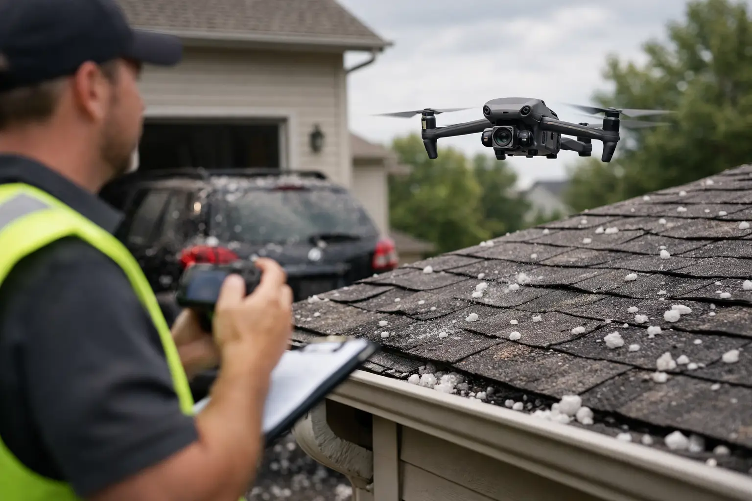
When a hail event moves through a commercial site, the first few hours matter. Operations teams need to know what was hit, how severe the impact appears, and whether there is an immediate risk to roofing systems, equipment, or exposed infrastructure. That is the real challenge behind how to assess hail damage quickly – not just spotting dents, but getting reliable documentation fast enough to support decisions.
For commercial and industrial properties, speed only helps if the process is disciplined. A rushed walkaround can miss damage on large roof areas, elevated assets, and equipment with limited access. On the other hand, waiting too long can slow claims, delay repairs, and leave water intrusion or compromised components unchecked.
How to assess hail damage quickly without creating more risk
The fastest path is not always putting more people on the roof. On warehouses, manufacturing plants, power facilities, telecom sites, and active construction projects, manual inspection can introduce unnecessary exposure. Wet surfaces, membrane damage, rooftop obstacles, energized environments, and post-storm debris all change the risk profile.
A better approach starts with triage. Confirm the storm path, identify the assets most likely to have taken impact, and separate immediate operational concerns from documentation needs. If there are signs of active leaks, visible punctures, damaged rooftop units, or compromised exterior components, those areas move to the front of the line. If the site is large, the inspection plan should focus first on critical systems and the most exposed roof sections rather than trying to review every square foot in random order.
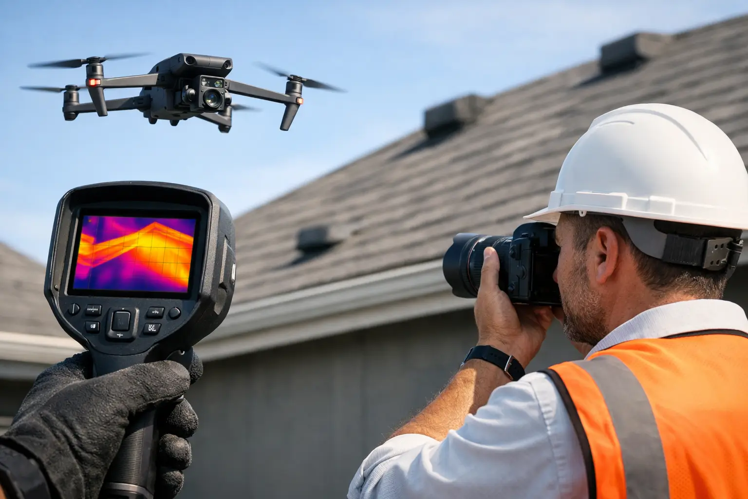
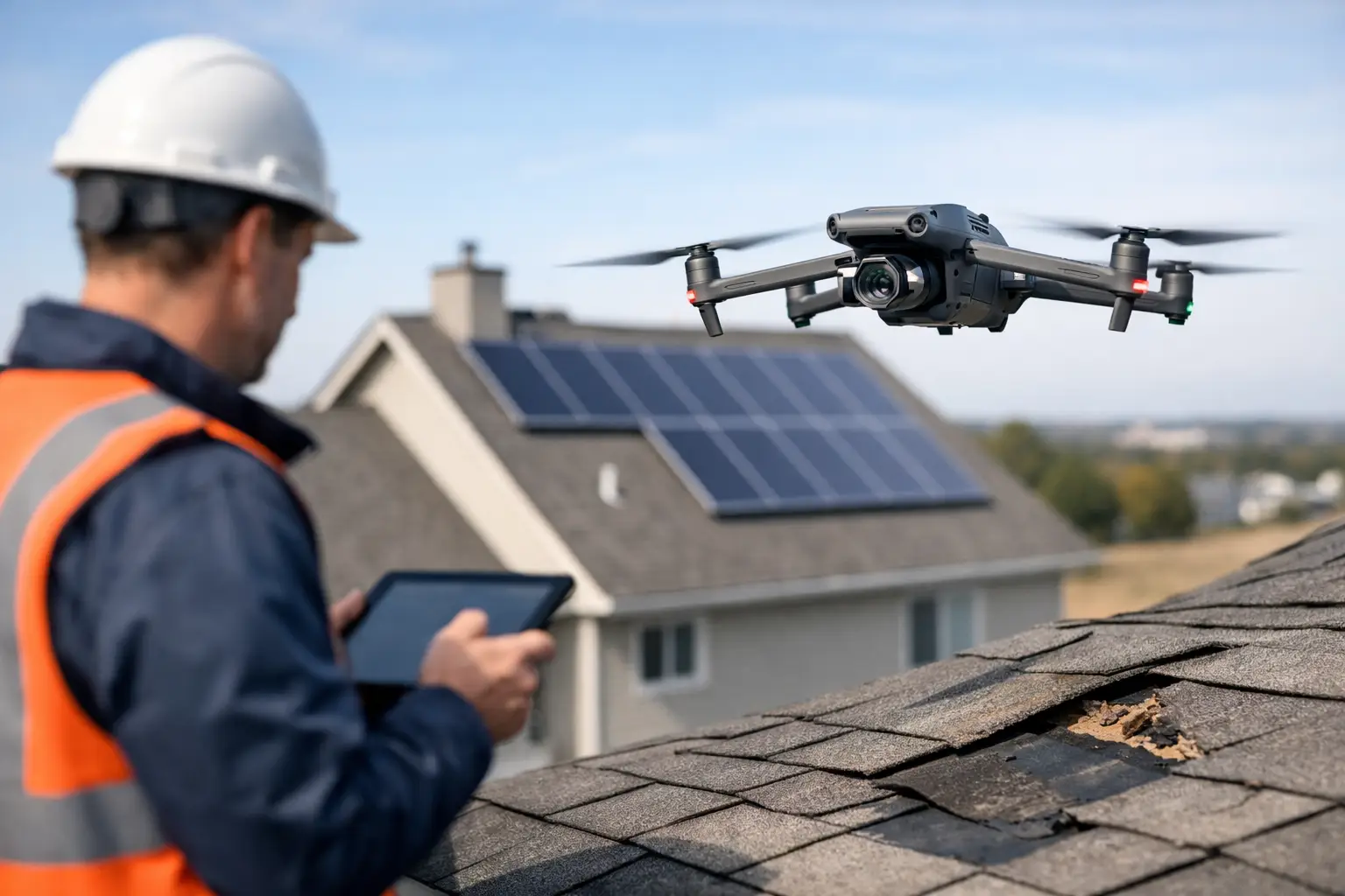
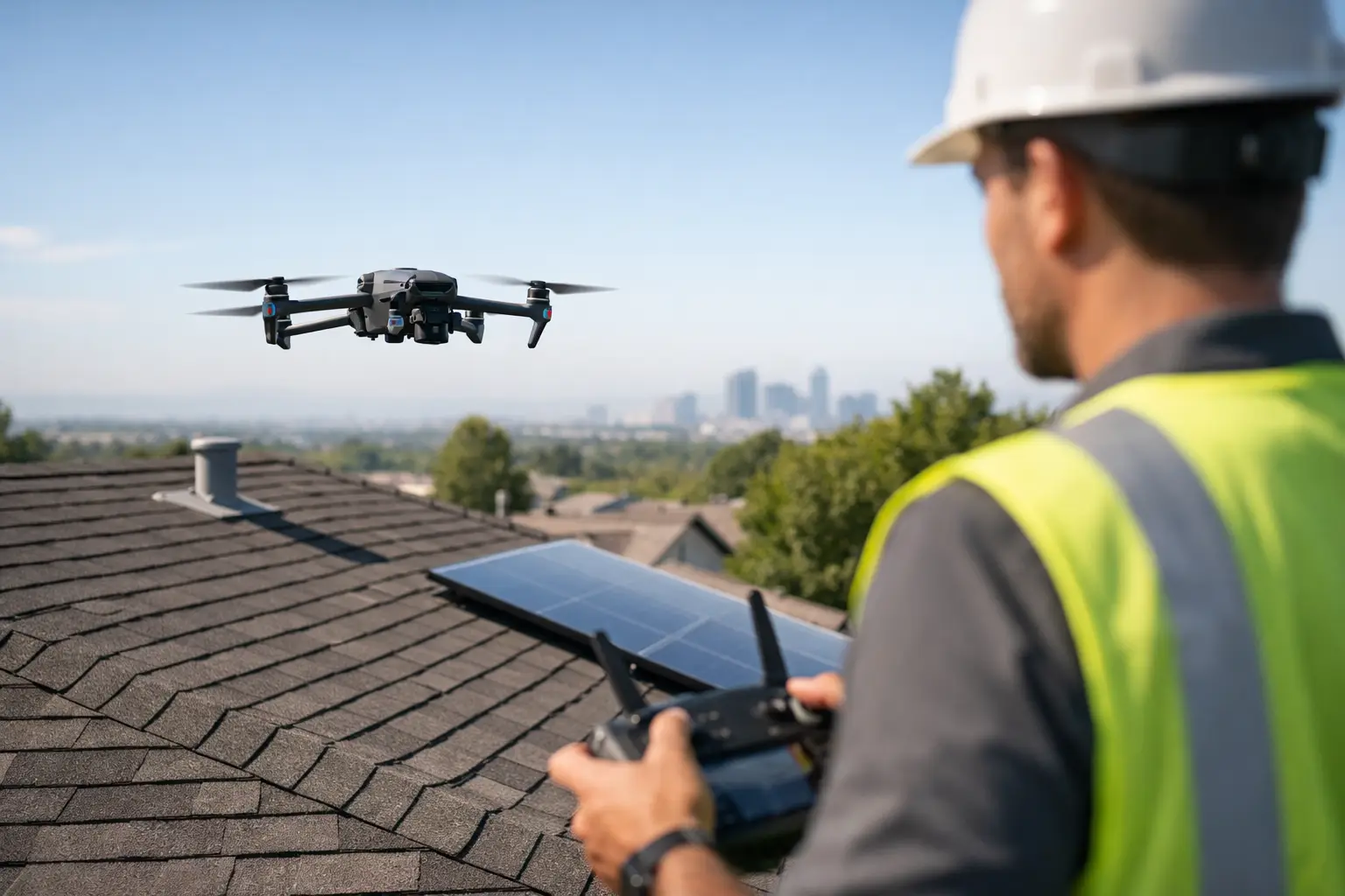
For many organizations, aerial inspection is the quickest way to establish that first layer of situational awareness. High-resolution drone imagery can cover large roof surfaces, elevated structures, and difficult access points in a fraction of the time required for manual methods. Just as important, it creates a visual record that maintenance teams, engineers, and insurance stakeholders can review without relying on scattered photos from multiple phones.
Start with a rapid damage triage
If you need a practical answer to how to assess hail damage quickly, begin by defining what you are trying to confirm. Most post-storm assessments fall into three buckets: no obvious impact, visible but limited impact, or likely widespread damage requiring follow-up inspection and repair planning.
That distinction matters because hail damage is not always dramatic. On commercial roofs, damage can show up as membrane bruising, punctures, displaced granules, metal deformation, flashing impacts, cracked skylights, dented units, and damage to exposed accessories. On industrial sites, the list may extend to vents, conduit covers, cooling equipment housings, panel enclosures, and other exposed components.
The first task is not to diagnose every defect. It is to document observable conditions well enough to guide the next move. That means capturing roof-wide context, close visual evidence in affected zones, and images of any collateral damage on mechanical equipment, wall systems, gutters, downspouts, or adjacent structures.
What to look for during a fast hail assessment
On single-ply roofing systems, inspectors are often looking for punctures, tears, surface marks, seam concerns, and impact areas around rooftop penetrations. On modified bitumen or built-up roofing, signs may include bruising, fractures, displaced surfacing, or exposed substrate. Metal roofing may show denting at panels, ridge caps, flashing, or trim. Each system reacts differently, which is why broad statements about damage can be misleading.
Mechanical and electrical equipment also deserve attention. Condenser fins, housings, control cabinets, covers, and exposed components can take direct impact even when the roof itself shows only moderate visible damage. On large facilities, that matters because the cost and operational consequence may sit in the equipment, not just the roofing assembly.
Windows, skylights, facade elements, and drainage components can provide useful clues about storm intensity and direction. If those features show concentrated strikes, it often helps narrow where roof damage may be heaviest. The same is true on construction sites, where temporary materials, exposed underlayment, and partially completed assemblies can be more vulnerable than finished areas.
Why documentation quality matters as much as speed
Fast assessment is only useful if the findings hold up under review. Poor image quality, missing context, and inconsistent labeling create friction later, especially when claims teams, consultants, or facility stakeholders need to compare conditions across multiple buildings or dates.
This is where disciplined aerial documentation has an advantage. Instead of isolated snapshots, a structured drone inspection can produce roof-overview imagery, directional closeups, mapped asset context, and repeatable visual records. For larger campuses or portfolios, that consistency helps decision-makers sort priority sites from lower-risk locations without sending separate crews everywhere at once.
There is also a practical trade-off. A quick visual scan may tell you that hail likely hit the property. It may not be enough to support repair planning, engineering review, or an insurance file on its own. In many cases, the right move is a phased response: first a rapid aerial assessment to identify likely problem areas, then targeted hands-on verification by the appropriate roofing, maintenance, engineering, or claims professionals.
Where manual inspection still fits
Drone-based assessment is strong at scale, speed, and access. It is not a replacement for every close inspection need. If imagery suggests punctures, seam separation, or equipment damage requiring physical verification, qualified personnel still need to confirm the condition directly.
That is especially true when moisture intrusion is suspected, when warranty questions are involved, or when the damage may affect operations in a regulated or high-consequence environment. The value of aerial intelligence is that it narrows the search area, reduces unnecessary roof traffic, and gives the team a documented starting point before more invasive steps begin.
In other words, fast assessment should reduce guesswork, not create false certainty.
Building a response workflow for large properties
Large commercial and industrial facilities need a method, not just a checklist. The most effective response usually starts with event confirmation and site prioritization, then moves into remote visual capture, preliminary condition review, and targeted escalation.
For example, a distribution center with several roof sections may need one building cleared for occupancy concerns, another flagged for active leak response, and a third documented for later claim support. A utility or telecom operator may need to review elevated structures and exposed equipment first because access is harder and service impact is more expensive. A contractor managing multiple active sites may need same-day imagery to determine which locations require tarp crews, material protection, or schedule adjustments.
That is why response time and deliverable quality matter together. Fast deployment helps, but so do organized image sets, location-based observations, and inspection documentation that can move across internal teams without being reworked from scratch.
How drones improve speed on complex assets
On a simple low-slope roof, manual assessment may be manageable. On a campus with multiple buildings, rooftop units, restricted access points, storm debris, or active operations below, the equation changes quickly.
Drone inspections help compress the time between storm event and usable intelligence. They allow teams to review broad roof areas, tall structures, and hard-to-reach components without staging ladders, lifts, or additional foot traffic in every location. For insurers and catastrophe-response teams, that can help process more sites in less time. For facility managers and project teams, it means earlier visibility into probable damage and a clearer path to next actions.
The best results come from operators who understand industrial field conditions, airspace compliance, site safety coordination, and the documentation standards expected by commercial stakeholders. This is not about getting dramatic aerial footage. It is about collecting inspection-grade visual data in a way that supports claims, maintenance planning, and operational decisions.
For organizations across Georgia, Alabama, South Carolina, and Tennessee, especially after severe weather moves across multiple properties, that kind of readiness can keep a storm response from turning into a documentation backlog.
Common mistakes that slow the process down
One mistake is assuming that if leaks are not visible, the site is fine. Hail damage can exist before interior symptoms appear. Another is sending too many people into hazardous areas before there is a basic visual picture of conditions.
A third problem is inconsistent evidence collection. Mixed photo angles, poor timestamps, and missing asset references can weaken internal reporting and create avoidable questions later. The final mistake is treating every site the same. A warehouse roof, an industrial plant, a substation support building, and a telecom facility do not carry the same access issues, risk profile, or inspection priorities.
Speed improves when the team matches the assessment method to the asset.
The most useful first look after a hail event is one that is fast, safe, and clear enough to move the next decision forward. If your property is large, elevated, active, or difficult to access, the right aerial documentation process can give your team that first answer without wasting time where it does not belong.