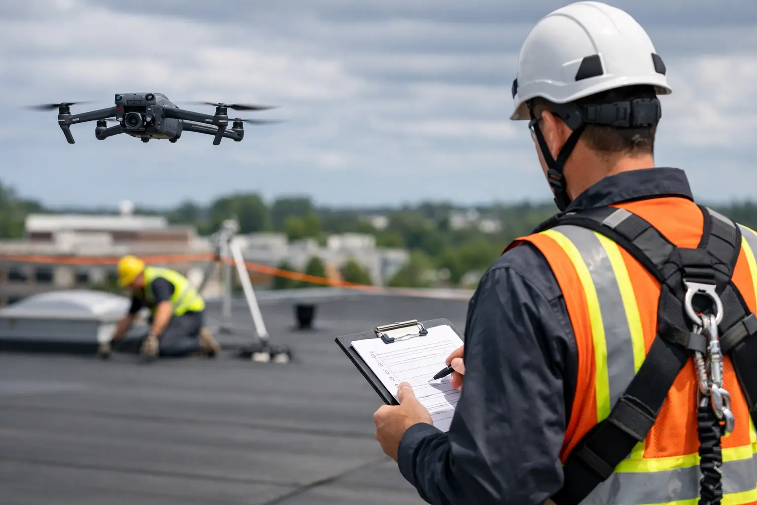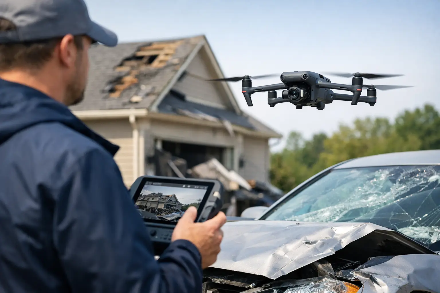
When a roof is compromised, a cooling tower takes storm damage, or a large industrial site needs post-loss documentation fast, the inspection method matters almost as much as the damage itself. A drone insurance claim inspection gives carriers, adjusters, and property stakeholders a safer and faster way to capture visual evidence without slowing the claim down with ladders, lifts, rope access, or avoidable site exposure.
For commercial and industrial claims, that difference is not minor. These sites are larger, riskier, and harder to document than a standard residential loss. The right drone workflow can help teams see more in less time, create a clearer record of conditions, and support better coordination between field personnel, desk adjusters, engineers, consultants, and owners.
What a drone insurance claim inspection actually does
At its core, a drone insurance claim inspection captures aerial documentation of damaged property and site conditions. That usually includes high-resolution imagery, video, and in some cases mapping, orthomosaics, or thermal imaging when the loss scenario calls for it. The goal is not to replace adjusters, engineers, or other specialists. The goal is to give them cleaner visual data so they can make decisions with less guesswork.
That distinction matters. In an insurance context, drones are a documentation and inspection support tool. They help record conditions across roofs, facades, utility structures, industrial assets, construction sites, and disaster-affected properties where manual access can be slow, expensive, or hazardous.
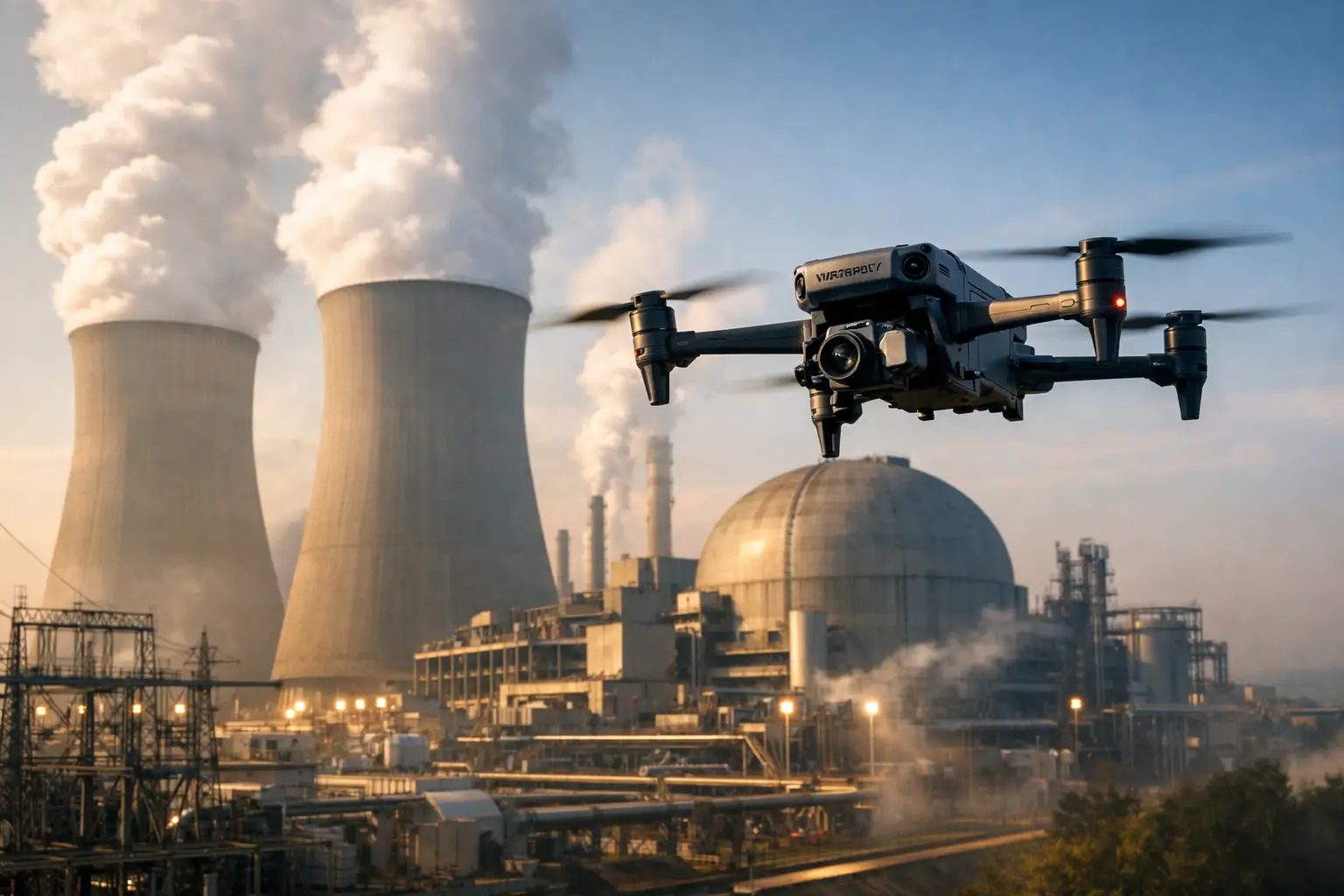
For a large commercial property, that might mean documenting membrane uplift across multiple roof sections. At an energy or utility facility, it may involve capturing visible exterior damage over a broad footprint while minimizing unnecessary personnel exposure. On a construction claim, it may mean preserving a time-sensitive visual record before cleanup, weather, or ongoing operations change the scene.
Why insurers and commercial property teams use drones
The biggest advantage is speed, but speed alone is not enough. A fast inspection that produces weak documentation does not help much. The value comes from combining speed with consistent image capture, broad site visibility, and reduced field risk.
After a storm or catastrophic event, claims teams often face access problems immediately. Roofs may be slick or unstable. Debris can block routes. Large facilities may have multiple structures, fenced areas, elevation changes, or active operational hazards. Sending people into every area first is not always practical.
A drone can often document the site condition from above before anyone commits to more labor-intensive access methods. That helps triage what needs closer review, what appears minor, and which areas deserve engineering attention. It also creates a visual baseline early in the claim, which is useful when conditions shift over time.
There is also a cost and workflow benefit. Traditional inspection methods on large assets may require lifts, scaffolding, shutdown coordination, or specialized access crews. Sometimes those steps are still necessary. Sometimes they are not. Drone data helps teams decide where close-up manual inspection is actually needed instead of applying expensive access methods across the entire property.
Where drone insurance claim inspection fits best
Not every loss requires aerial deployment, but many commercial and industrial claims benefit from it. Wind and hail losses are the obvious examples, especially on expansive roofing systems. Fire losses can also benefit when teams need exterior condition documentation before structural access is expanded. Flood and storm events often involve broad site damage, standing water, debris fields, washouts, and hard-to-reach equipment locations that are easier to assess from above.
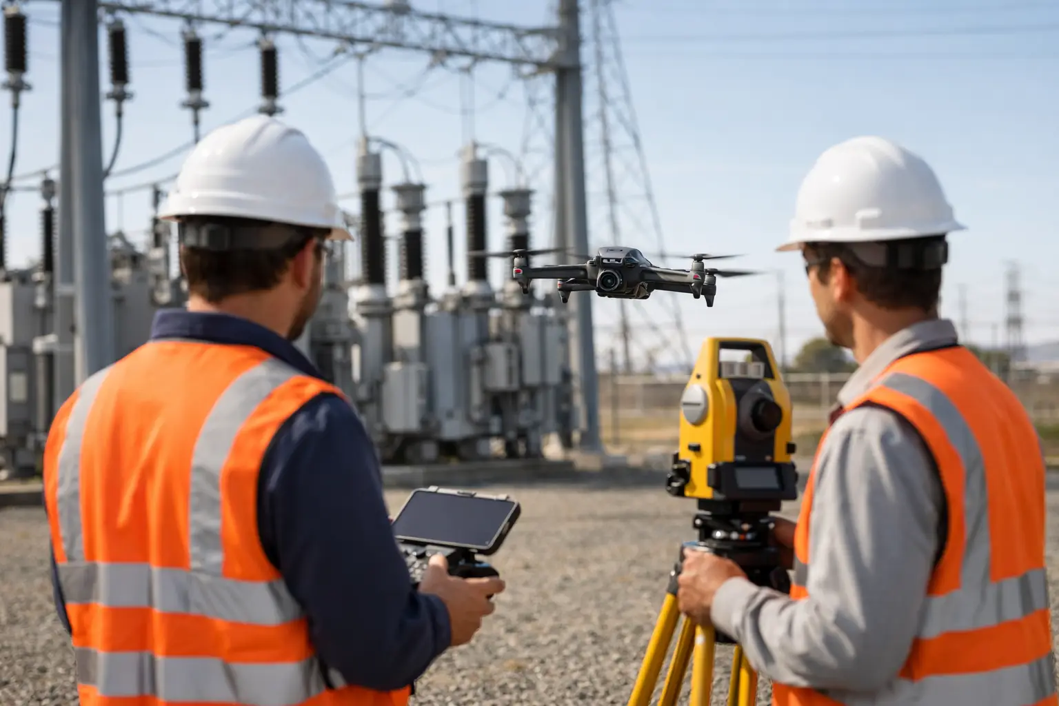
This approach is especially useful on assets that are difficult to inspect conventionally, including industrial rooftops, telecom structures, substations, tanks, cooling towers, process areas, and large construction projects. It also helps when decision-makers are distributed. A field team may be on site while carrier representatives, consultants, and internal stakeholders are reviewing conditions remotely. Good aerial documentation gives everyone the same visual reference.
The larger and more complex the property, the more valuable disciplined aerial data becomes. On a small single-structure claim, the gains may be modest. On a campus-style facility or infrastructure-heavy site, they can be substantial.
What good claim documentation looks like
A useful drone inspection is not just a flight with a camera. It needs a plan. The operator should know what the claim team is trying to document, what deliverables are needed, what hazards exist on site, and how the imagery will be used downstream.
That usually means capturing more than a few overview shots. Adjusters and consultants often need wide context images, directional passes, area-specific close visuals, and repeatable coverage that supports comparison. If the loss affects a roof, for example, the imagery should show the whole roof layout as well as suspected impact zones, drainage paths, penetrations, edge conditions, mechanical areas, and transitions between sections.
On larger claims, mapping products can add real value. Orthomosaic outputs can help teams review the overall site in a measurable, consistent format. This is useful when multiple parties need to identify damaged zones, annotate areas of concern, or compare field conditions against plans and prior documentation.
Thermal imaging can also support certain workflows, but it depends on the loss and the inspection objective. It may help reveal moisture patterns, heat anomalies, or areas that warrant further evaluation. It should be treated as supporting data, not a final diagnosis.
The operational side that gets overlooked
The quality of a drone insurance claim inspection depends heavily on field discipline. That includes flight planning, safety controls, communication with site contacts, compliance with airspace and facility restrictions, weather judgment, and consistent data handling after the flight.
This is where commercial and industrial claims separate serious drone providers from casual operators. Active job sites, utility corridors, industrial campuses, and disaster zones are not forgiving environments. Crews need to understand site protocols, maintain situational awareness, and work within the limits of the location and the mission.
FAA Part 107 certification is one baseline. Professional insurance coverage is another. But beyond that, claims work benefits from a provider that understands chain-of-documentation concerns, the need for repeatable capture, and the reality that inspection support often happens under time pressure. Fast deployment matters, but so does getting the site documentation right the first time.
Limits and trade-offs to keep in mind
Drones are highly effective, but they are not a universal answer. Dense interior spaces, covered areas, and certain structural conditions may still require hands-on inspection. Weather can delay flights. Restricted airspace or site-specific operating constraints may require additional planning. In some cases, operations at the facility itself limit where and when a drone can fly safely.
There is also a practical limit to what imagery alone can establish. Drone data can document visible conditions exceptionally well. It can support measurements, mapping, and review. It can help identify areas that need further evaluation. What it should not do is stand in for engineering judgment, causation analysis, or formal structural conclusions when those are required.
That is not a weakness. It is simply proper use. The best claims workflows treat drone inspection as a force multiplier for the broader response team.
Choosing the right provider for commercial claims
For commercial and industrial losses, the key question is not whether a provider owns a drone. It is whether they can operate reliably in demanding environments and deliver usable claim documentation. That means understanding safety, access limitations, client communication, file organization, and the difference between attractive aerial visuals and inspection-grade records.
A capable provider should be able to work with adjusters, site managers, consultants, and operations personnel without creating confusion on site. They should know how to capture what matters, not just what looks dramatic. They should also be prepared for large properties, hazardous surroundings, and time-sensitive deployments.
That is especially relevant across storm-prone regions where insurers and asset owners may need rapid response after wind, hail, or severe weather events. In states such as Georgia, Alabama, South Carolina, and Tennessee, where large industrial sites and commercial facilities are common, having a field-ready drone partner can shorten the path from loss occurrence to documented site condition.
Why this matters more on complex assets
Simple claims can survive imperfect documentation. Complex claims usually cannot. When the property includes multiple buildings, active operations, expensive equipment, or restricted access zones, poor field data creates delays. People revisit the site. Questions stay open longer. Different parties work from different assumptions.
A disciplined drone insurance claim inspection reduces that friction. It helps create a common visual record early, improves visibility across hard-to-reach areas, and supports safer field operations on properties where manual inspection alone may be too slow or too risky.
For organizations managing commercial, industrial, and infrastructure-related losses, that is the real value. Better aerial documentation does not make the claim simple, but it gives the people responsible for resolving it a clearer place to start.